Catalog Archive
Auction 170, Lot 399

"Tabago Dresse sur des Arpentages Nouveaux Par Jeffreys an 1775 Traduit de l'Anglois", Le Rouge, George Louis
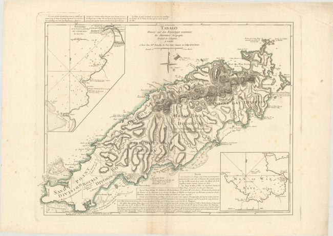
Subject: Tobago

Period: 1777 (circa)

Publication:

Color: Hand Color

Size:
23.9 x 18.8 inches
60.7 x 47.8 cm
Download High Resolution Image
(or just click on image to launch the Zoom viewer)

This is a very scarce map of the island of Tobago vividly portraying the mountainous terrain and numerous protective bays. The chart is a French issue of Thomas Jefferys' map of 1775. The map illustrates the rapid development of sugar plantations; each large division is noted with the number of estates (286 total) and acreages. Only a small, mountainous portion of the island is undeveloped. The map depicts the Indian villages, watering places, forts (including a demolished French fort), rocks, shoals, and anchorages with very specific navigational notations. Two large insets depict Great & Little Courland Bays and Man of War Bay.

References: MCC-10 (Tobago) #42.

Condition: B+

Original outline color and wide original margins with a bit of faint foxing and a soft fold near center.

Estimate: $400 - $475

Unsold

Closed on 11/14/2018

Archived