Catalog Archive
Auction 170, Lot 268

"[Lot of 2] Rough Sketch of That Part of Red River in Which the Great Raft Is Situated... [and] Map of Red River with Its Bayous and Lakes in the Vicinity of the Raft [with reports]", U.S. Government
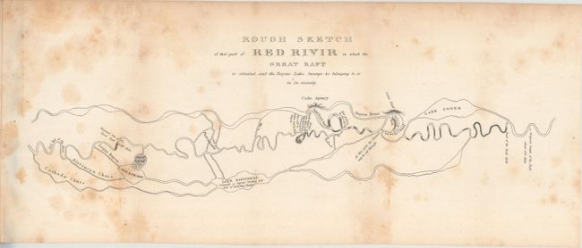
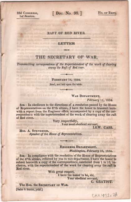
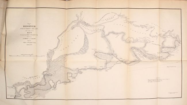
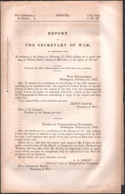
Subject: Louisiana

Period: 1834-55 (published)

Publication:

Color: Black & White

Size:
See Description
Download High Resolution Image
(or just click on image to launch the Zoom viewer)

A. Rough Sketch of That Part of Red River in Which the Great Raft Is Situated, and the Bayous, Lakes, Swamps &c. Belonging to, or in Its Vicinity, bound in Letter from the Secretary of War, Transmitting Correspondence of the Superintendent of the Work of Clearing Away the Raft of the Red Iver, from H.R. Doc. 98, 23rd Congress, 1st Session, published 1834 (19.0 x 5.8"). This basic map covers the lower Red River and demonstrates the "Great Raft" that reached its peak in the 1830s. The Great Raft was a huge log jam that covered approximately 150 miles and resulted in high water levels in the river and created new lakes and bayous. Steamboat builder and head of the Western River Improvements for the Corps of Engineers, Captain Henry Miller Shreve, began systematically removing these obstacles, but the process would not be completed until the latter part of the century. Shreveport, Louisiana is named in his honor. The map is still bound in his 13-page report on the project. Condition: Scattered foxing. (B)

B. Map of Red River with Its Bayous and Lakes in the Vicinity of the Raft, bound in Report of the Secretary of War ... Report and Map of Colonel Fuller's Survey of Red River..., from Sen. Ex. Doc. 62, 33rd Congress, 2nd Session, published 1855 (23.4 x 11.8"). This map shows soundings in the Red River from Shreveport to its confluence with Red Bayou. The 13-mile length of the river is marked and tributaries, topography, and adjacent lakes are indicated. Dutch Johns, Marks, Soda and Shiftail lakes are located. Ownership of numerous land holdings are also noted on this detailed chart. The map is accompanied by a 6-page report from the Secretary of War regarding Colonel Fuller's survey of the Red River. Condition: Clean and crisp. (A)

References:

Condition:

See description above.

Estimate: $170 - $200

Sold for: $120

Closed on 11/14/2018

Archived