Catalog Archive
Auction 170, Lot 152

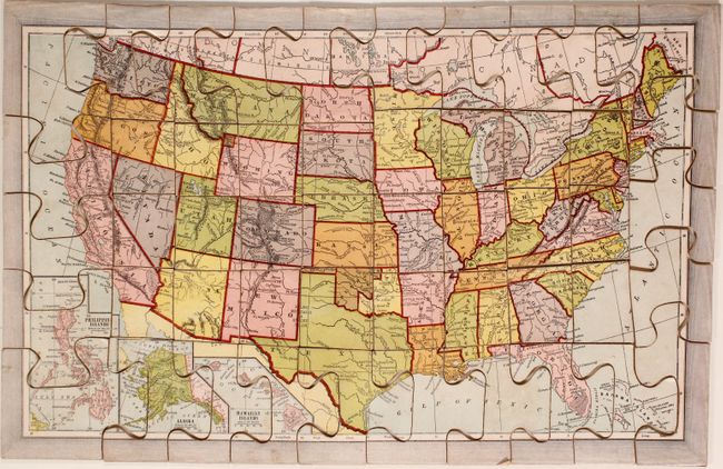
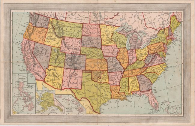
"Dissected Map of the United States", McLoughlin Bros.

Subject: United States

Period: 1890 (circa)

Publication:

Color: Printed Color

Size:
17.5 x 11.3 inches
44.5 x 28.7 cm
Download High Resolution Image
(or just click on image to launch the Zoom viewer)

Terrific Victorian period map puzzle with original box. Complete with all 50 pieces, box, and full color map to aid in assembling the puzzle. This example was published sometime around 1890 or shortly thereafter given that Dakota Territory is now shown divided into the states of North and South Dakota. The original paper label on the box is reminiscent of a cigar box label as it combines the printing processes of multi-stone chromolithography, solid color zinc plate, and gold stamping to produce a beautiful image.

McLoughlin Bros., Inc. was a New York publishing firm that pioneered the systematic use of color printing technologies in children's books, particularly between 1858 and 1920. The firm's publications served to popularize illustrators including Thomas Nast, William Momberger, Justin H. Howard, Palmer Cox, and Ida Waugh. By 1886, the firm published a wide range of items including cheap scrapbooks, large folio picture books, linen books, puzzles, games and paper dolls.

References:

Condition: B+

The puzzle is very good with light surface soiling and a small abrasion in Arizona. The folding guide map has minor soiling from use and a few fold separations that have been closed on verso with archival tape. The box is moderately worn and stained.

Estimate: $200 - $230

Sold for: $130

Closed on 11/14/2018

Archived