Catalog Archive
Auction 170, Lot 118

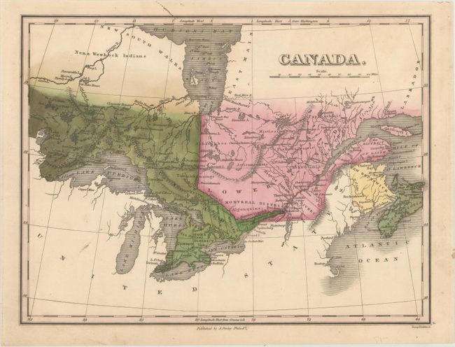
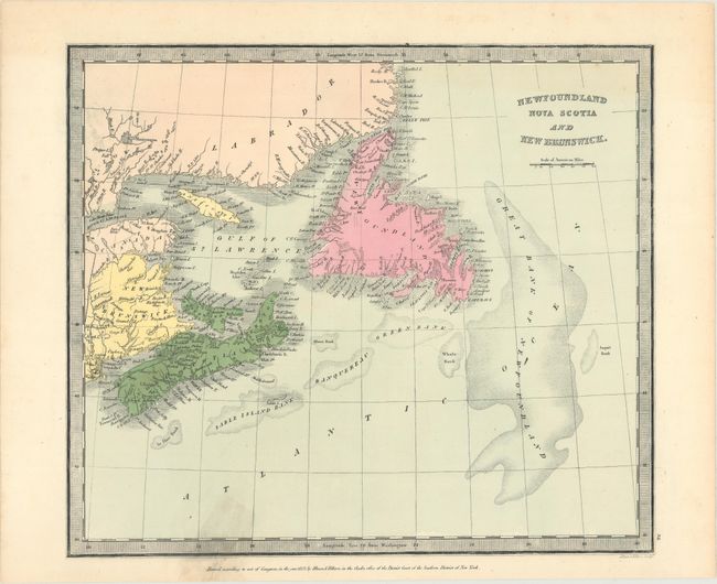
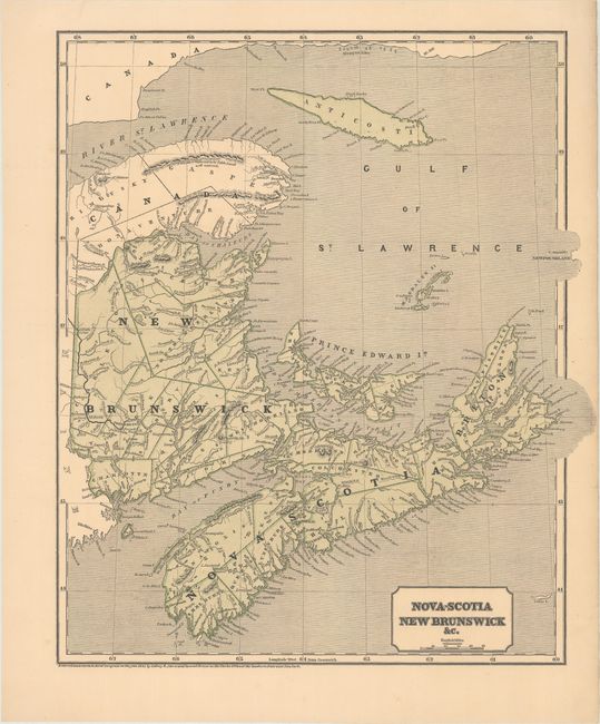
"[Lot of 3] Canada [and] Newfoundland Nova Scotia and New Brunswick [and] Nova-Scotia New Brunswick &c.",

Subject: Eastern Canada

Period: 1824-43 (circa)

Publication:

Color:

Size:
See Description
Download High Resolution Image
(or just click on image to launch the Zoom viewer)

A nice lot featuring three atlas maps of the region from the first half of the 19th century including:

A. Canada, by Anthony Finley, from A New General Atlas, circa 1824, hand color (11.3 x 8.4"). This finely engraved copper plate map covers all of Upper and Lower Canada extending from the Lake of the Woods region to the Gulf of St. Lawrence to include New Brunswick and Nova Scotia. Engraved by Young & Delleker. Reference: Phillips (Atlases) #752-5. Condition: Original color on a heavy sheet. (A)

B. Newfoundland Nova Scotia and New Brunswick, by Illman & Pilbrow, dated 1833, hand color (12.3 x 10.7"). This map extends from the Maritimes to Newfoundland and the coast of Labrador. Presents good detail along the coastlines and names many islands in the Gulf of St. Lawrence. Condition: On a clean sheet with a 1" edge tear at bottom that is repaired on verso with archival tape with an old tape stain visible on recto. (B+)

C. Nova-Scotia New Brunswick &c., by Sidney E. Morse and Samuel Breese, dated 1843, printed color (12.7 x 14.8"). An attractive map of the Canadian Maritimes, extending north to Anticosti Island and the southern coast of Labrador. Issued in the first atlas to utilize the cerographic (wax) engraving process. Condition: A crisp example with an edge tear at right that just enters the border that has been closed on verso with archival tape. There is a faint, horizontal crease running across the middle of the map. (B+)

References:

Condition:

See description above.

Estimate: $100 - $130

Sold for: $50

Closed on 11/14/2018

Archived