Catalog Archive
Auction 169, Lot 774

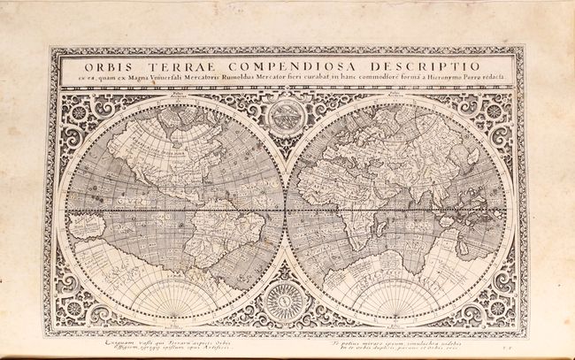
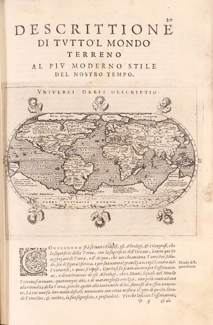
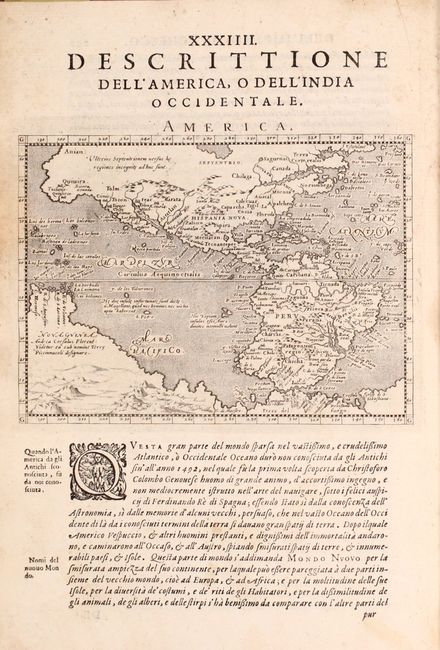
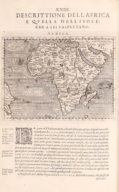
An Attractive Italian Edition of Ptolemy's Geographia

"Geografia cioe Descrittione Universale della Terra Partita in Due Volumi...", Magini, Giovanni Antonio

Subject: Atlases

Period: 1598 (published)

Publication:

Color: Black & White

Size:
8.2 x 11.9 inches
20.8 x 30.2 cm
Download High Resolution Image
(or just click on image to launch the Zoom viewer)

This complete, Italian edition of Ptolemy's Geographia was printed in Venice by the brothers Giovanni Battista and Giorgio Galignani. The translation of the text from Latin to Italian was completed by Leonardo Cerneti from Magini's 1596 work. The volume is divided into two parts with 64 total maps including both Ptolemaic (27) and modern maps (37). The modern maps consist of the world (3), Europe (22), Africa (2), Asia (9), and America (1). Among the many remarkable maps are the following:

Orbis Terrae Compendiosa Descriptio…forma a Hieronymo Porro Redacta. This intricately engraved double-hemisphere map was based on Rumold Mercator's 1587 world map and was re-engraved in a reduced format by Girolamo Porro. The amount of detail that has been retained from the larger map is remarkable. The map is surrounded by an elaborate strapwork border, and an armillary sphere and 32-point compass rose are tucked between the hemispheres. The North Pole is depicted as a landmass surrounding a sea from which four rivers radiate and there is a well depicted Northwest Passage. The huge Terra Australis is shown as a part of Tierra del Fuego, and the lands of Lucach, Maletur and Beach (from the travel account of Marco Polo) are noted along the coast in the vicinity of present day Australia with a large island labeled Iava Minor located in the same region. Japan is shown in a kite-shaped configuration, with the fictitious Satyrorum insule (Satyr's Island) shown above. South America has a bulge on its southwest coast, and New Guinea is depicted in a large, circular configuration. The map embodies many ancient authorities and is a wonderful view of classical cartography. Reference: cf. Shirley #194.

Universi Orbis Descriptio. This map is based on Abraham Ortelius' world map on an oval projection. The most notable features are the large landmasses at both poles. Six wind-heads are arranged above and below the map. The map was very popular and subsequently appeared in Lasor a Varea's work more than a century after it was first engraved. Reference: Shirley #195.

America. This finely engraved map is derived from Giovanni Lorenzo d'Anania's 1582 map of the Americas and further based on the geography of Ortelius. Most notable is the characteristic bulge to the west coast of South America and the huge Southern Continent that attaches to Nova Guinea. Anian and Quivira appear on North America's bulbous western coast. Reference: Burden #93.

Quarto, hardbound in full leather with raised bands on spine.

References: Mickwitz & Miekkavaara (Nordenskiold Vol. 2) #226; Phillips (A) #405; Sabin #66506.

Condition: B+

Contents are mostly clean and bright with map condition ranging from very good to near fine. There is some occasional surface soiling, light toning, minor foxing, and tiny worm tracks mostly in the right blank margin that have been archivally repaired. The maps of Russia and Europe include some old coloring. Binding is very good with only minor shelf wear and light staining.

Estimate: $7,000 - $8,500

Sold for: $4,500

Closed on 9/12/2018

Archived