Catalog Archive
Auction 169, Lot 679

"Imperii Sinarum Nova Descriptio", Cluver, Philipp

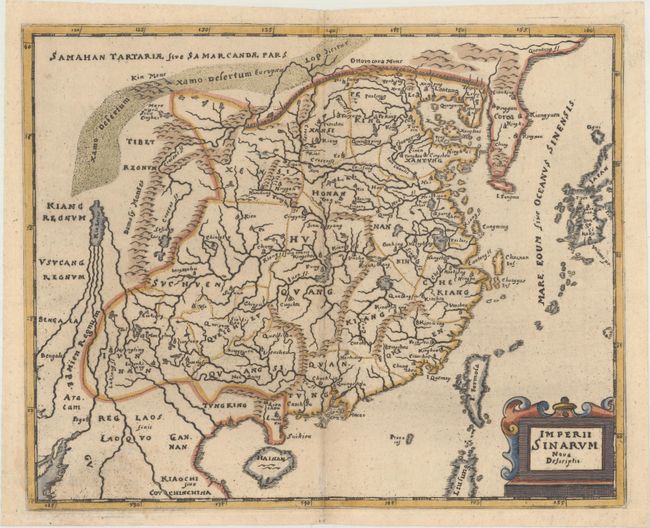
Subject: China & Korea

Period: 1667 (circa)

Publication: Introductionis in Universam Geographiam...

Color: Hand Color

Size:
10.2 x 8.3 inches
25.9 x 21.1 cm
Download High Resolution Image
(or just click on image to launch the Zoom viewer)

Handsome small map based on the important Martini/Blaeu map of the Chinese Empire. It shows a fair number of provinces and cities named in the interior. The Great Wall is depicted along the northern border. A large fictitious interior lake labeled Kia Lacus is the source of five large, southern rivers. The map extends to include Formosa, Korea and parts of Japan and Laos. Embellished with a strapwork title cartouche.

Cluver's Introductio in Universam Geographicam was a popular atlas, appearing in over 45 editions during a 100-year period. The first edition was published without maps in the 1620s, and the first edition to include maps was published circa 1641. The various editions were published in different cities throughout Europe, including Amsterdam, Nuremberg, and London. This example was published in an edition with maps by Conrad Buno.

References: Shirley (BL Atlases) T.CLUV-5a #30.

Condition: A

Minor creasing along the centerfold.

Estimate: $275 - $350

Sold for: $150

Closed on 9/12/2018

Archived