Catalog Archive
Auction 169, Lot 493

"Provinciae, Regionis Galliae, Vera Exactissimaq Descriptio. Petro Ioanne Bompario Auctore", Ortelius, Abraham

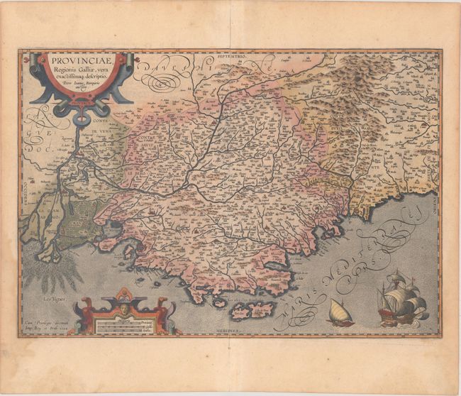
Subject: Southern France

Period: 1603 (published)

Publication: Theatrum Orbis Terrarum

Color: Hand Color

Size:
20.1 x 13.7 inches
51.1 x 34.8 cm
Download High Resolution Image
(or just click on image to launch the Zoom viewer)

This superb map of the region of Provence along the Mediterranean extends from the Camargue region in the west to past Nice in the east, and as far north as Gap. The Rhone River delta is well depicted, and the Durance River is shown winding through the region. The map is filled with tiny villages, and larger cities are depicted as castles, including Marseille, Nice, Aix, Avignon, and Arles. The map is handsomely adorned with a pair of sailing ships and two strapwork cartouches. The map is based on Jean Pierre de Bompar's single-sheet map of Provence published in 1591. Dated 1594 but published in 1603. Latin text on verso.

References: Van den Broecke #47.

Condition: B+

Nice impression and color with a 7" fold separation and associated tear in the upper half of the image that has been repaired on verso with archival tissue. A light dampstain just touches the border at lower right and left.

Estimate: $325 - $400

Sold for: $200

Closed on 9/12/2018

Archived