Catalog Archive
Auction 169, Lot 415

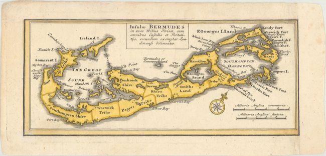
"Insulae Bermudes in suas Tribus Divisae, cum Omnibus Castellis et Fortalitijs, Secundum Exemplar Londinense Delineatae", Homann Heirs

Subject: Bermuda

Period: 1759 (circa)

Publication:

Color: Hand Color

Size:
11.1 x 4.7 inches
28.2 x 11.9 cm
Download High Resolution Image
(or just click on image to launch the Zoom viewer)

This little map of Bermuda was copied from Herman Moll's map of the island circa 1729. Oriented with north to the top right of the sheet, the map shows the island divided into tribes. This map was trimmed from a sheet that contained five charts describing the islands of St. Kitts, Antigua, Bermuda, Barbados, and Jamaica, Dominia Anglorum in Praecipuis Insulis Americae.

References: Sellers & Van Ee #1723.

Condition: A

Excellent impression, remargined at top and right with period correct paper.

Estimate: $100 - $140

Sold for: $75

Closed on 9/12/2018

Archived