Catalog Archive
Auction 169, Lot 396

"[Lot of 3] Carte du Bresil, Prem. Partie. Depuis la Riviere des Amazones Jusqua la Baye de Tous les Saints... [and] Suite du Bresil Depuis la Baye de Tous les Saints... [and] Suite du Bresil... ", Bellin, Jacques Nicolas
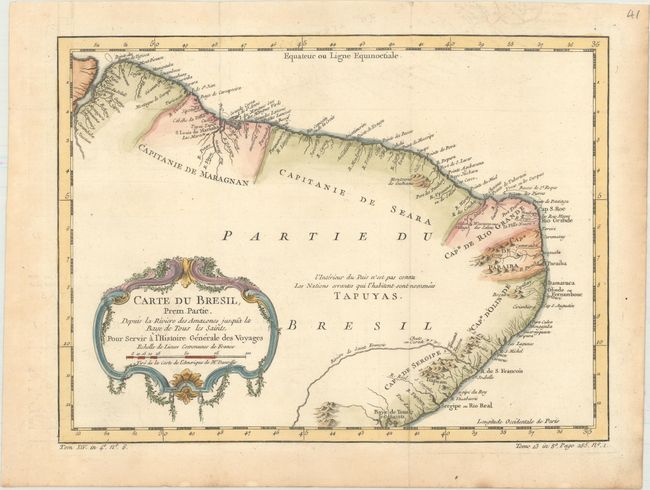
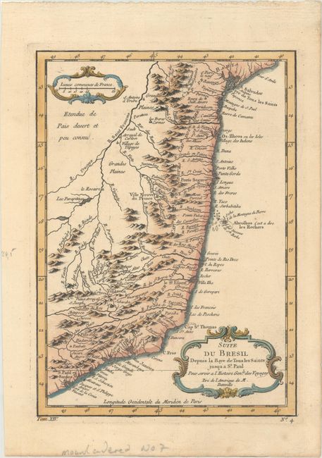
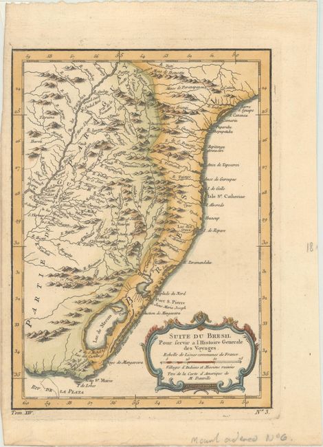
Subject: Brazil

Period: 1757 (circa)

Publication: Prevost's Histoire Generale des Voyages

Color: Hand Color

Size:
See Description
Download High Resolution Image
(or just click on image to launch the Zoom viewer)

These three matched maps cover the entire Brazilian coastline and show the capitaincies or hereditary harbor offices. The first map covers from the mouth of the Amazon to Baía de Todos os Santos. Only coastal detail is shown with the interior region noted as being unknown and the domain of the Tapuyas Indian nation. The other two maps continue down the coast to the Rio de la Plata and provide more information on the interior.

A. Carte du Bresil, Prem. Partie. Depuis la Riviere des Amazones Jusqua la Baye de Tous les Saints, pour Servir a l'Histoire Generale des Voyages, (12.8 x 9.4").

B. Suite du Bresil Depuis la Baye de Tous les Saints Jusqu' a St. Paul pour Servir a l'Histoire Genle des Voyages, (6.6 x 9.3").

C. Suite du Bresil pour Servir a l'Histoire Generale des Voyages, (6.8 x 9.3").

References:

Condition: A

Light toning along the edges of the sheet with remnants of hinge tape on verso. The first map was issued folding.

Estimate: $200 - $230

Unsold

Closed on 9/12/2018

Archived