Catalog Archive
Auction 169, Lot 376

"[Lot of 2] Carte de la Terre Ferme du Perou, du Bresil et du Pays des Amazones... [and] Carte du Paraguay, du Chili, du Detroit de Magellan &c....", Delisle, Guillaume

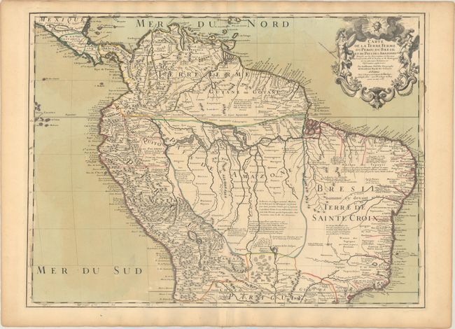
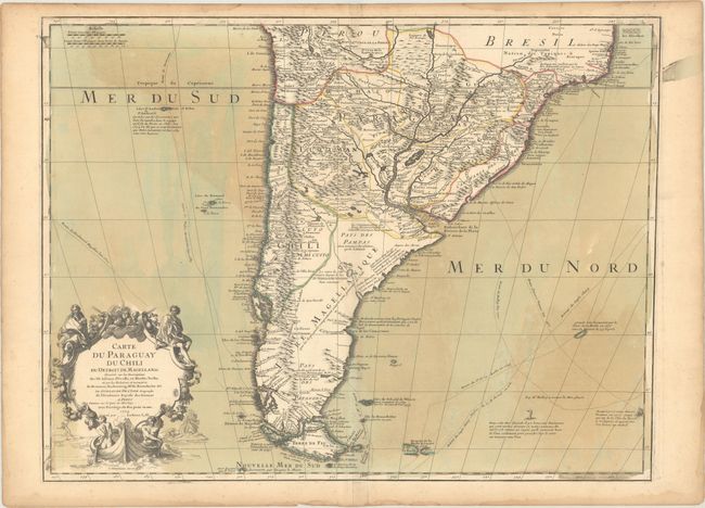
Subject: South America

Period: 1703 (dated)

Publication:

Color: Hand Color

Size:
25.9 x 19.1 inches
65.8 x 48.5 cm
Download High Resolution Image
(or just click on image to launch the Zoom viewer)

Fabulous matched pair of boldly engraved maps that together cover the continent. Size given is for each sheet, and varies slightly. Joined size would be 22.5" x 38". It is unusual to find these maps together.

The northern sheet is filled with information and notations speculating about the Indian tribes and the tributaries of the Amazon. The capitaineries are shown along the coast of Brazil. A notation in Guyana notes the mythical Lac de Parime on which the golden city of Manoa del Dorado was supposed to be located. The central part of the map (Pays des Amazones) is filled with Indian names. The Inca Way (Grand chemin des Ingas) is shown from Chuquisaca in Peru to Pasto in Colombia. The title cartouche features mythical Amazon warriors, a pot of gold and King Louis XIV, as the Sun King.

The southern sheet is filled with great topographical detail and notations throughout. The tracks of Magellan, Sarmiento, Brower, Beauchesne, Sharp, Sr. de la Roche, Halley and Vespucci are marked, and Amerigo Vespucci's ship is shown sailing in the Atlantic. The title cartouche features the Notus (the south wind) and Native American figures.

References:

Condition: B+

Nice impressions on watermarked paper with original wash and outline color. There is light offsetting, archivally repaired centerfold separations confined to the bottom blank margin on each sheet, and light toning along the edges of the sheets.

Estimate: $550 - $700

Sold for: $325

Closed on 9/12/2018

Archived