Catalog Archive
Auction 169, Lot 356

"Carte de l'Isle de la Jamaique aux Anglois avec les Passages Entre Cette Isle et Celles de St. Domingue, et de Cuba", Buache, Philip
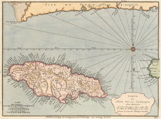
Subject: Jamaica

Period: 1740 (dated)

Publication: Plans des Isles, Rades, et Ports de Plusieurs Lieux en Amerique

Color: Hand Color

Size:
12.6 x 9.3 inches
32 x 23.6 cm
Download High Resolution Image
(or just click on image to launch the Zoom viewer)

Although the focus of this map is Jamaica, portions of Cuba and Hispaniola are depicted to show Jamaica's relative position within the Greater Antilles. The map shows good detail with scores of place names along the coast plus parishes, mountains, rivers, watersheds, and other details in the interior.

References: Kapp (MCC-42) #60.

Condition: A

Excellent impression on wide-margined paper with a large medallion watermark and light soiling along the edges of the sheet.

Estimate: $350 - $425

Sold for: $250

Closed on 9/12/2018

Archived