Catalog Archive
Auction 169, Lot 326
"Originalkarte der Californischen Halbinsel nach den Aufnahmen der fur die Lower California Company...", Petermann, Augustus Herman
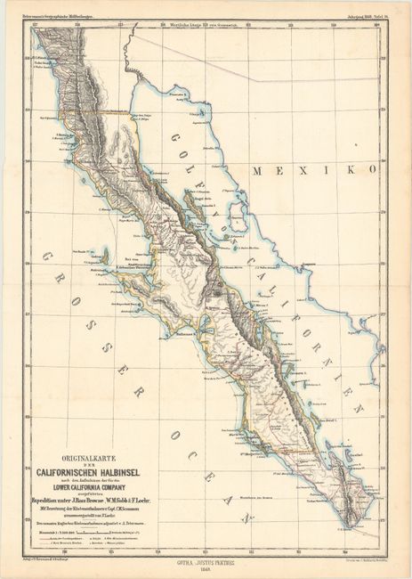
Subject: Mexico, Baja California
Period: 1868 (dated)
Publication: Petermann's Geographische Mittheilungen
Color: Hand Color
Size:
9 x 13.2 inches
22.9 x 33.5 cm
Download High Resolution Image
(or just click on image to launch the Zoom viewer)
(or just click on image to launch the Zoom viewer)