Catalog Archive
Auction 169, Lot 254

"A New Map of Louisiana with Its Canals, Roads & Distances from Place to Place, Along the Stage & Steam Boat Routes", Thomas, Cowperthwait & Co.
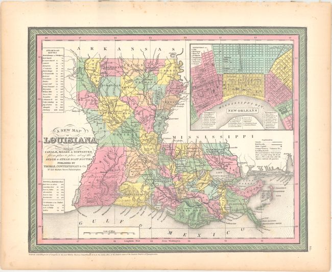
Subject: Louisiana

Period: 1850 (dated)

Publication: A New Universal Atlas...

Color: Hand Color

Size:
14.4 x 11.6 inches
36.6 x 29.5 cm
Download High Resolution Image
(or just click on image to launch the Zoom viewer)

This map of Louisiana locates numerous towns and villages, roads, railroads, canals, and rivers. County configurations are current to 1848 with the newly created Bienville County appearing in the northern part of the state. There is a large and detailed plan of New Orleans at top right with a key identifying districts and places of interest, and three tables at left give the steamboat routes between New Orleans and Pittsburgh, Natchitoches, and Balize. A handsome map with decorative borders. Published in 1851, this is an early Cowperthwait issue as Mitchell had just been erased from the title.

References:

Condition: B+

Original color with a few faint spots of foxing and minor toning along the sheet edges.

Estimate: $140 - $170

Sold for: $100

Closed on 9/12/2018

Archived