Catalog Archive
Auction 169, Lot 146

"Carte des Lacs du Canada pour Servir a l'Histoire Generale des Voyages", Bellin, Jacques Nicolas

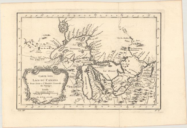
Subject: Colonial Central United States & Canada, Great Lakes

Period: 1757 (dated)

Publication: Prevost's Histoire Generale des Voyages

Color: Black & White

Size:
11.5 x 7.7 inches
29.2 x 19.6 cm
Download High Resolution Image
(or just click on image to launch the Zoom viewer)

This is an excellent French & Indian War period map depicting the five Great Lakes. While this map uses the same title as Bellin's prototype map of the Great Lakes, published in Charlevoix’s Histoire et Description Generale de la Nouvelle France in 1744, it has been updated with information from Bellin's similar map of 1755. Lakes Erie and Ontario are more accurately defined and the spurious islands in Lake Huron have been eliminated. However, several large, bogus islands still remain in Lake Superior, including I. Minong (called I. Philippeaux on some issues) and I. Pontchartrain. The Michigan peninsula is still misshapen with a massive mountain range down its center. Numerous forts are located: S. Jgnace, Niagara, des Miamis, and Toronto to mention a few. The ornate rococo title cartouche is draped with ivy.

References: Kershaw #953; cf. Tooley (MCC-96) #871; Portinaro & Knirsch #CXXVI.

Condition: A

A dark impression on a clean sheet with a hint of offsetting. Issued folding.

Estimate: $400 - $475

Sold for: $325

Closed on 9/12/2018

Archived