Catalog Archive
Auction 169, Lot 126
"Plan du Bassin de Quebec et de Ses Environs", Bellin, Jacques Nicolas
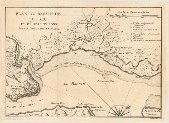
Subject: Quebec City, Canada
Period: 1744 (dated)
Publication: Histoire et Description Generale de la Nouvelle France
Color: Black & White
Size:
11 x 7.8 inches
27.9 x 19.8 cm
Download High Resolution Image
(or just click on image to launch the Zoom viewer)
(or just click on image to launch the Zoom viewer)