Catalog Archive
Auction 168, Lot 84

"Western Hemisphere", Neele & Son

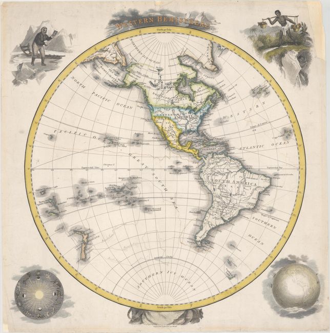
Subject: Western Hemisphere - America

Period: 1815 (circa)

Publication:

Color: Hand Color

Size:
14.6 x 15.1 inches
37.1 x 38.4 cm
Download High Resolution Image
(or just click on image to launch the Zoom viewer)

This decorative map of the Western Hemisphere extends to show New Zealand and various islands in the southwest Pacific Ocean. There is nice detail of the major rivers and some place names in the Americas, including New York, Boston, Washington, Williamsburg, Charleston, and New Orleans. New Albion and the present-day American Southwest are still part of Mexico. The northern border of Alaska is speculative and surrounded by "impenetrable ice." A fragment of Sandwich Land peeks out of the Antarctic Circle. The map is surrounded by four striking vignettes showing an Inuit staring into a mirror (top left), a native hoisting fruit while another mines underground (top right), a zodiac chart (bottom left), and a globe with ships traversing the oceans (bottom right). Engraved by Neele & Son.

References:

Condition: B+

On a watermarked sheet with several manuscript notations delineating explorers' tracks and marginal soiling. There are some chips and tears along the sheet's edges, including one that just enters the image at top, which have been repaired with archival materials.

Estimate: $275 - $350

Sold for: $100

Closed on 6/6/2018

Archived