Catalog Archive
Auction 168, Lot 82

Impressive Four-Sheet Map Featuring Two Possible Locations for a <i>River of the West</i>

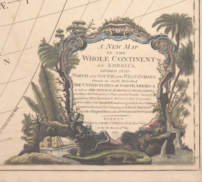
"A New Map of the Whole Continent of America, Divided into North and South and West Indies. Wherein Are Exactly Described the United States of North America...", Laurie & Whittle

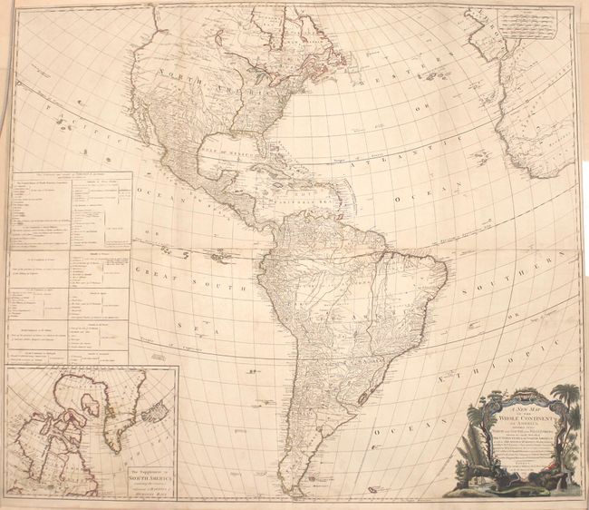
Subject: Western Hemisphere - America

Period: 1794 (dated)

Publication:

Color: Hand Color

Size:
46.8 x 40.6 inches
118.9 x 103.1 cm
Download High Resolution Image
(or just click on image to launch the Zoom viewer)

An impressive, four-sheet map of North and South America, originally drawn by John Gibson in 1763 with a slightly different title. The map went through several revisions; this being the final state. The huge map is filled with incredible detail and is based on D'Anville's cartography, as well as Spanish explorations on the west coast of North America and the journals of Governor Pownall in New England and Canada. The new United States is shown with its boundary on the Mississippi River. In the west are two possible locations for a River of the West; one with its source at Pike's Lake, the other further north at Lake Winnipeg. A Chinese colony, Fou Sang is shown in present-day British Columbia. At lower left is an inset map of Hudson and Baffin's Bay. Above the inset is a large text panel listing of the states and the colonial possessions of the various European powers. The baroque style title cartouche features a beaver, a crocodile, an Indian headdress amid trees, a waterfall and tropical flora.

References: Tooley (America) p. 52, #3.f; McGuirk #112.

Condition: B+

Original outline color with later color in the cartouche. There is light soiling and offsetting, with minor toning along the horizontal joint. There are professional repairs to separations along the centerfolds of the sheets, as well as to a handful of very short tears, primarily along the edges of the sheet.

Estimate: $1,400 - $1,700

Unsold

Closed on 6/6/2018

Archived