Catalog Archive
Auction 168, Lot 684

"Tartaria sive Magni Chami Imperium", Ortelius/Vrients
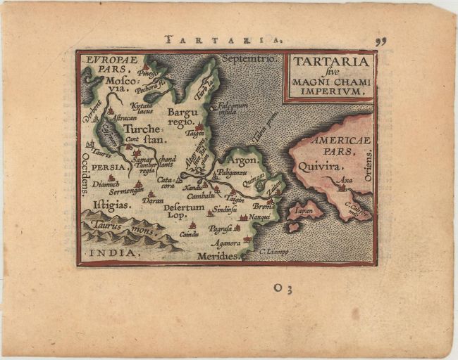
Subject: North Pacific Ocean

Period: 1601 (published)

Publication: Epitome Theatri Orteliani

Color: Hand Color

Size:
4.2 x 3.1 inches
10.7 x 7.9 cm
Download High Resolution Image
(or just click on image to launch the Zoom viewer)

While designed to illustrate the expansive kingdom of the Great Khan in Asia, this tiny map's main feature is the unnamed strait separating Asia and North America based on the theory of Giacomo Gastaldi. Near the southern entrance to this straight is a large and strangely shaped Japan. In North America, the city of Axa and C. Califormio are named. Latin text on verso.

This map was published in Filips Galle's series of Epitome, which first appeared in 1588. Galle was unimpressed with the maps in the Spieghel der Wereld, and therefore gradually replaced nearly all of them through the various editions of his Epitome. The new maps had simple double-lined borders and were widely copied by others. The plates were acquired by Jan Baptist Vrients circa 1600, who published three more editions in 1601 and 1602, retouching some of the plates and replacing a few more. By the time Vrients' 1601 edition was published, only 10 of the original maps remained.

References: Burden #125; King (2nd Ed.) pp. 64-65 & 88-89; Van der Krogt (Vol. III) #8050:332.

Condition: B+

A dark impression with light toning and marginal soiling.

Estimate: $140 - $170

Sold for: $80

Closed on 6/6/2018

Archived