Catalog Archive
Auction 168, Lot 423

"Europae I Tab:", Ptolemy/Mercator
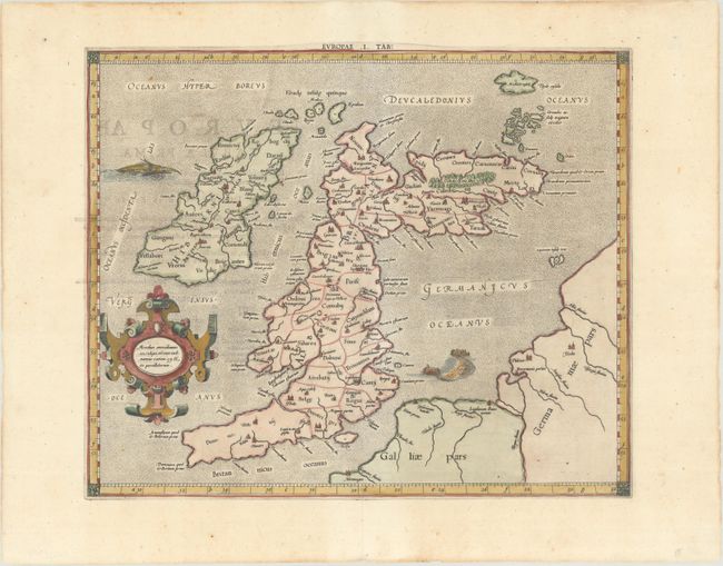
Subject: Britain

Period: 1618 (published)

Publication: Theatrum Geographiae Veteris

Color: Hand Color

Size:
16.1 x 13.3 inches
40.9 x 33.8 cm
Download High Resolution Image
(or just click on image to launch the Zoom viewer)

Claudius Ptolemy was a mathematician, astronomer and geographer who worked in Alexandria, then a part of the Roman Empire, in the 2nd century AD. One of the most learned and influential men of his time, his theories dominated both astronomy and geography for nearly 1500 years. His writings were kept alive by Arabic scholars during the Middle Ages and reemerged in Europe during the Renaissance. The birth of printing led to wide dissemination of his great works on astronomy and geography. There were a number of editions of his Geographia beginning in 1477. These early editions contained maps based on his original writings, known as Ptolemaic maps. As geographic knowledge increased with the explorations of Columbus, Magellan, Cabot and others, maps of the New World were added, and maps of the Old World were revised. Ptolemy's Geographia continued to be revised and published by some of the most important cartographers including Martin Waldseemuller, Sebastian Munster, Giacomo Gastaldi, Jodocus Hondius, and Gerard Mercator (whose last edition was published in 1730).

This fine Ptolemaic map of the British Isles shows ancient place names and divisions. Scotland is presented with its distinctive east-west orientation. The map is decorated with a strapwork title cartouche, a sea monster and a fishing scene in the North Sea. Mercator originally published this map in his 1578 edition of Ptolemy's great Geography; this is from the last edition and a crack in the plate at top is evident in this example. Although he is most renowned today for the projection he popularized and for first using the term 'atlas' for a collection of maps, he devoted much of his life to his Ptolemaic maps. The maps were beautifully engraved as nearly as possible to their original form and decorated with strapwork cartouches and interesting vignettes reflecting the customs of the region. This is the first state, published by Petrus Bertius, Isaac Elsevier and Jodocus Hondius Jr.

References: Mickwitz & Miekkavaara #232-2; Shirley (BI to 1650) #123; Van der Krogt (Vol. I) #0901:1.1.

Condition: A

A nice impression with professional repairs to centerfold separations at top and bottom. There are a couple of minor tears along the edges of the sheet.

Estimate: $350 - $425

Sold for: $275

Closed on 6/6/2018

Archived