Catalog Archive
Auction 168, Lot 417

"Map of the Countries Between England & India Designed to Shew the Over-Land and Sea-Routes to the East...", Wyld, James

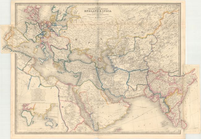
Subject: Europe & Western Asia

Period: 1853 (circa)

Publication:

Color: Hand Color

Size:
36.4 x 24.4 inches
92.5 x 62 cm
Download High Resolution Image
(or just click on image to launch the Zoom viewer)

This large-scale map focuses on the trade routes by both land and sea between England and India. The map is filled with detail of cities, roads (with distances between cities), railroads, shipping routes, and political boundaries. At bottom left is an inset of the entire eastern hemisphere illustrating the various sea routes between England and China. This map was published by James Wyld, Geographer to the Queen and successor to William Faden, who maintained the high standard of graphic and factual excellence that had been established by his predecessor and his maps are among the finest published in the early nineteenth century. Printed on four sheets, joined as issued.

References:

Condition: B+

Original outline color with minor soiling. The majority of the original linen tape on verso that attached the top portion of the map is still present, and the areas where it is missing have been professionally reattached with archival material. A minor amount of the paper is lifting from the original linen tape at top center.

Estimate: $275 - $350

Sold for: $220

Closed on 6/6/2018

Archived