Catalog Archive
Auction 168, Lot 384

"[On 3 Sheets] Carte de la Meridiene Mesuree au Royaume de Quito... / Karte von der Gemessenen Mittagslinie in dem Koenigreiche Quito...", Ulloa, Antonio de
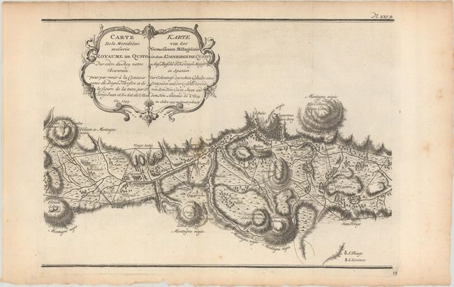
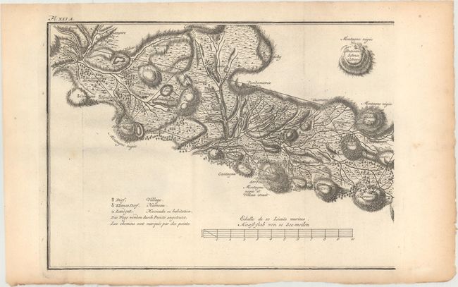
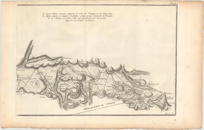
Subject: Equador

Period: 1744 (dated)

Publication:

Color: Black & White

Size:
13 x 9.2 inches
33 x 23.4 cm
Download High Resolution Image
(or just click on image to launch the Zoom viewer)

This rare map appeared in Antonio de Ulloa and Jorge Juan's Relacion Historica del Viaje a la America Meridional..., a seminal work on South American geography, culture, and history written by the two scientists after nearly a decade spent exploring the continent. Spaniards Ulloa and Juan were appointed to the French Geodesic Mission to South America. The purpose of the mission was to measure a degree of meridian arc at the equator, and the chosen location for the measurements was Ecuador. The measurements would then be compared with similar measurements made near the North Pole, with the goal of determining the true shape of the earth.

This map gives great topographical detail of the area to the east and west of Quito, Ecuador. A series of triangulation lines are depicted based on the measurements by Ulloa and Juan. Numerous small towns, villages, rudimentary roads, and even volcanoes are identified. This edition includes titles in both French and Dutch and does not include the decorative elements around the cartouche found in the Spanish version. Printed on three sheets that would measure approximately 39 x 9" if joined.

References: cf. Shirley (BL Atlases) G.ULL-1a #5.

Condition: B+

Issued folding on watermarked paper with a few spots of foxing and light toning along the sheet edges.

Estimate: $350 - $425

Sold for: $180

Closed on 6/6/2018

Archived