Catalog Archive
Auction 168, Lot 324

"[Lot of 2] Californien, Oregon, Utah und Neu-Mejico [and] Mexico, Mittel-America, Texas", Flemming, Carl

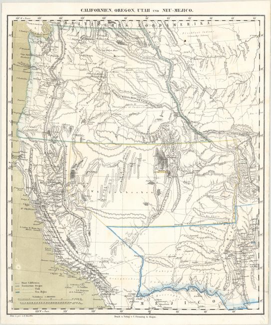
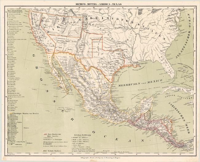
Subject: Western United States & Mexico

Period: 1850 (circa)

Publication:

Color: Hand Color

Size:
See Description
Download High Resolution Image
(or just click on image to launch the Zoom viewer)

A. Californien, Oregon, Utah und Neu-Mejico (13.6 x 15.7"). Handsome German map that depicts the state of California and the large western territories of Oregon, Utah and New Mexico. Oregon extends to the Canadian border, encompassing all of Washington. Salt Lake City is named New Jerusalem. The border with Mexico is on the Gila River. Filled with Indian names, a few forts, and some interesting conjectural topography.

B. Mexico, Mittel-America, Texas (16.4 x 12.9"). A nice map showing early territorial and state borders in the Southwest. California had just become a state in 1850 and Texas is presented with its final, post 1850 borders. A notation (in German) in the panhandle of Texas shows the "summer range of the Comanches." The topography in the Southwest and Great Basin region is mostly spurious. The map extends to include all of Central America, with a color-coded key at bottom.

References:

Condition: A

Mostly clean, bright examples with a few faint spots.

Estimate: $250 - $325

Sold for: $75

Closed on 6/6/2018

Archived