Catalog Archive
Auction 168, Lot 312

"A New & Accurate Map of Mexico or New Spain Together with California New Mexico &c. Drawn from the Best Modern Maps & Charts & Regulated by Astronl. Observns.", Bowen, Emanuel

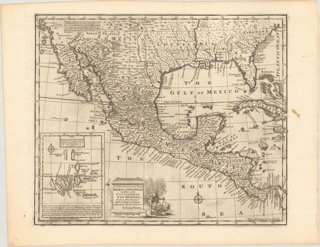
Subject: Southern United States, Mexico & Central America

Period: 1747 (circa)

Publication: A Complete System of Geography

Color: Black & White

Size:
16.6 x 13.8 inches
42.2 x 35.1 cm
Download High Resolution Image
(or just click on image to launch the Zoom viewer)

This nicely engraved map covers the region from California to South Carolina, as well as all of Mexico, Central America, Cuba and Jamaica. A descriptive legend in southern California gives credit to Father Kino for discovering that California is a peninsula rather than an island. There are a number of settlements along the Rio Grande as well as Cenis Fort and several settlements in Texas. Inset at the lower left has a great little map of the Galapagos Islands, including some interesting notes on their discovery in 1684 and the origin of the name. The title cartouche features a vignette of a man subduing a pair of natives.

References: Shirley (BL Atlases) T.BOW-2a #57; Wheat (TMW) #126.

Condition: A

A dark impression, issued folding with light printer's ink residue and a stain in the right blank margin. This map was deaccessioned from the Sondley Library, whose blind stamp is visible on verso.

Estimate: $400 - $500

Sold for: $275

Closed on 6/6/2018

Archived