Catalog Archive
Auction 168, Lot 289

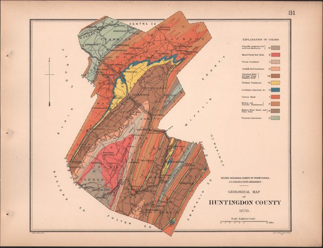
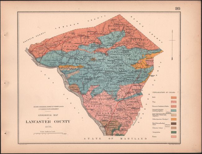
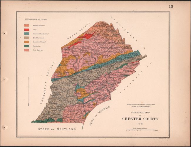
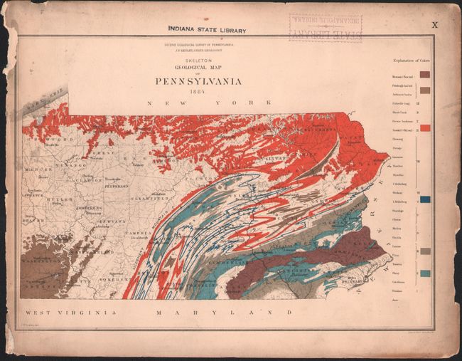
"Geological Hand-Atlas of the 67 Counties of Pennsylvania",

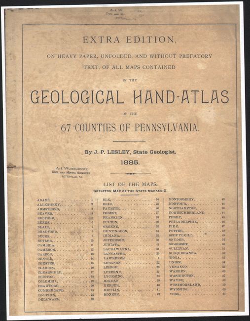
Subject: Pennsylvania, Geological Atlas

Period: 1885 (published)

Publication:

Color: Printed Color

Size:
11.9 x 9.3 inches
30.2 x 23.6 cm
Download High Resolution Image
(or just click on image to launch the Zoom viewer)

The Second Geological Survey of Pennsylvania began after the Civil War and was overseen by J. P. Lesley, who became state geologist in 1875 and served in that capacity until 1889. From these efforts, Lesley published this limited edition, enlarged atlas presenting the geology of Pennsylvania. This first edition issue should not to be confused with Lesley's more common, smaller octavo version. The atlas contains a total of 61 county maps and 1 index map of the entire state and is arranged in alphabetical order. Each map shows geologic ages, rock types and formations described in a legend, and also identifies cultural features including cities, towns, railroads, and roads. Lithographed by Julius Bien in New York. The maps are loose and accompanied by 4to, oblong, blue cloth and marbled paper boards.

References:

Condition: B+

The atlas is disbound and should be considered a loose collection of maps, which are all in very good to near fine condition with pleasant light toning. The exception is the index map that has light soiling, a chip in the left border, and a library stamp along the top border (B). Title page is missing (a photocopy is provided). There are library stamps and a bookplate on the pastedowns and manuscript title and call numbers on the front cover. Covers are worn and soiled.

Estimate: $200 - $250

Sold for: $100

Closed on 6/6/2018

Archived