Catalog Archive
Auction 168, Lot 264

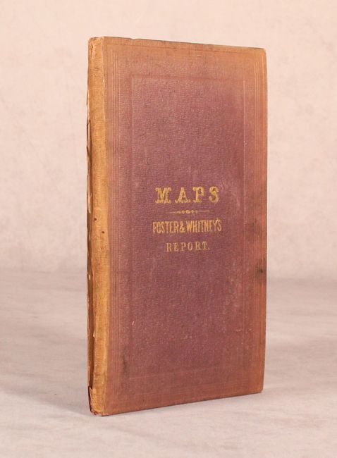
"[3 Bound Maps] Geological Map of the Lake Superior Land District... [and] Section and Diagram Illustrating the Geology of the Region... [and] Geological Map of the District Between Keweenaw Bay and Chocolate River...", Foster/Whitney

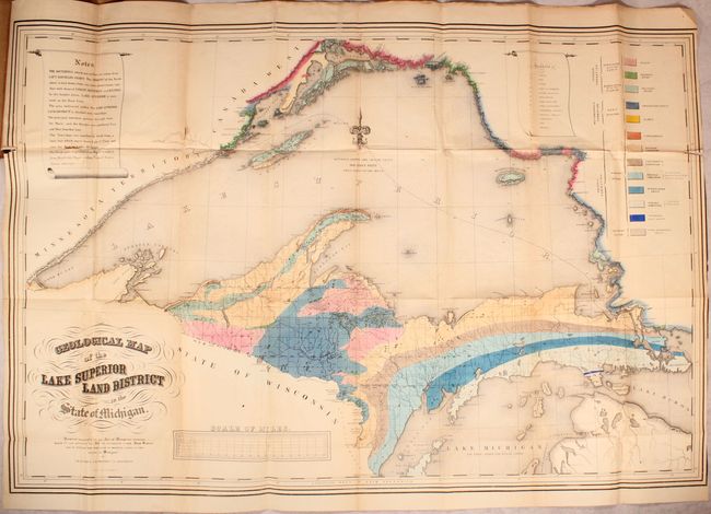
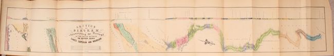
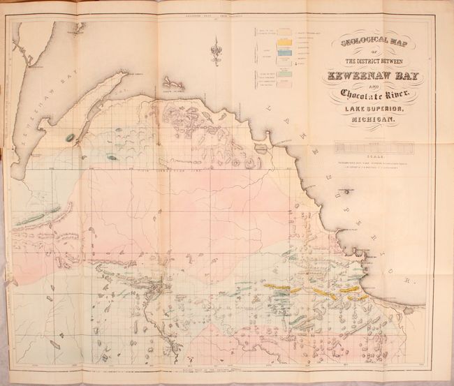
Subject: Michigan, Lake Superior

Period: 1847 (dated)

Publication:

Color: Hand Color

Size:
5.8 x 9.2 inches
14.7 x 23.4 cm
Download High Resolution Image
(or just click on image to launch the Zoom viewer)

This is the small atlas volume to accompany Foster & Whitney's Report on the Geology of the Lake Superior Land District. It includes the following three maps:

A. Geological Map of the Lake Superior Land District in the State of Michigan (38.9 x 25.8"). A striking map that shows the geology of the Upper Michigan Peninsula, Isle Royale and the north shore of Lake Superior and indicates copper, iron, silver, marble furnaces, iron forages and active/inactive mines. A key at right identifies thirteen different geological types, and the map is centered on a beautiful fleur-de-lys. Condition: There is an 8" binding tear at left that has been archivally repaired along with a few other minor repaired separations primarily at the fold intersections.

B. Section and Diagram Illustrating the Geology of the Region Between the Northern Shores Lakes Superior and Michigan (47.4 x 6.4"). Covers the region from Thunder Bay in Lake Superior along the Canadian border south to Green Bay on Lake Michigan. Includes a cross section at top.

C. Geological Map of the District Between Keweenaw Bay and Chocolate River, Lake Superior, Michigan (23.6 x 19.3"). This detailed geological map covers the region from the Keweenaw Bay to the Chocolate River. A color-coded key locates seven geological types, including sandstone, quartz, limestone, schistose and trappean rocks, granite and basalt. There is also good detail of relief shown in hachure. A scale below the title converts chains to miles. Fancy title lettering. Condition: There are two short tears that just enter the map border at left as well as a few tiny chips at left to just inside the border.

Octavo, hardbound in brown, blind-stamped cloth with gilt title on front cover.

References: Marcou & Marcou #367, #368 & #369.

Condition: B

Issued folding with light toning and offsetting. See description for additional detail on the maps. Covers are sunned and the hinge is nearly detached.

Estimate: $400 - $475

Sold for: $200

Closed on 6/6/2018

Archived