Catalog Archive
Auction 168, Lot 224

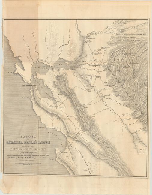
"Sketch of General Riley's Route Through the Mining Districts July and Aug. 1849...", Derby, George Horatio (Lt)

Subject: Central California

Period: 1849 (dated)

Publication:

Color: Black & White

Size:
19.2 x 20.6 inches
48.8 x 52.3 cm
Download High Resolution Image
(or just click on image to launch the Zoom viewer)

This important and early map of the California Gold Rush was made from Lt. Derby's original sketch by J. Mc. H. Hollingsworth in the office of the 10th Military Dept. It is historically important, not only for its depiction of Gen. Riley's route, but because it names, for the first time, certain actual mining camps in the middle Sierra foothills; Mormon Island (misspelled Mormont), Coloma (mislabeled Colluma), Curtis, Sullivan's, Corons, Jamestown, Woods, and Sonora. The entire route of the Riley party is noted, with the dates of their visits to the various camps, and covers the region from Monterrey Bay, north to Sacramento and east to the gold diggings.

References: Wheat (Gold) #79.

Condition: B

Issued folding with light toning and offsetting, and a few faint dampstains along the left border. There is a 1" edge tear at left that has been closed on verso with archival tape, and a few small chips that also enter the border at left.

Estimate: $250 - $325

Sold for: $180

Closed on 6/6/2018

Archived