Catalog Archive
Auction 168, Lot 19

"A New Map of the Terraqueous Globe According to the Ancient Discoveries and Most General Divisions of It into Continents and Oceans", Wells, Edward
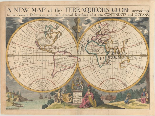
Subject: World

Period: 1701 (circa)

Publication: A New Sett of Maps Both of Antient and Present Geography…

Color: Hand Color

Size:
20.1 x 14.6 inches
51.1 x 37.1 cm
Download High Resolution Image
(or just click on image to launch the Zoom viewer)

This is one of a pair of world maps Wells included in his A New Sett of Maps... and depicts California as an Island. The northwest coast of North America is left blank and North America is noted as perhaps being "no other, than the Insular Atlantis of the Ancients." The eastern coastline of Australia is not yet formed and New Zealand is also only partially delineated. The map is surrounded by lovely engraved scenes including the royal coat of arms and a dedication to His Highness William, Duke of Gloucester, who was attending Oxford where Wells was a teacher of mathematics and geography and who appears with his tutor under the tree on the right. On either side of the dedication are small landscapes, one of ships arriving in the New World and one of the Sheldonian Theater in Oxford. Engraved by Michael Burghers.

References: Shirley #608; Shirley (BL Atlases) T.WELL-1a #1.

Condition: B

A nice impression, issued folding with light toning and soiling and an archivally repaired tear that extends 6" into the image at bottom center.

Estimate: $1,100 - $1,400

Sold for: $680

Closed on 6/6/2018

Archived