Catalog Archive
Auction 168, Lot 197

"[Lot of 3] Map No. 10. United States [and] Utah and New Mexico [and] Washington & Oregon Territories",

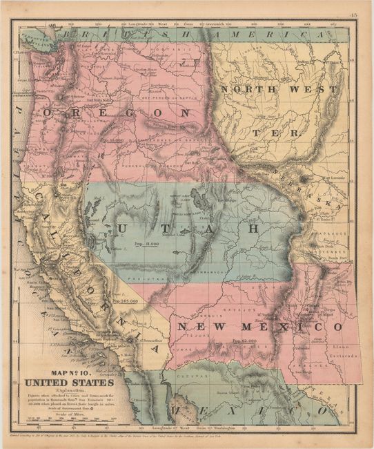
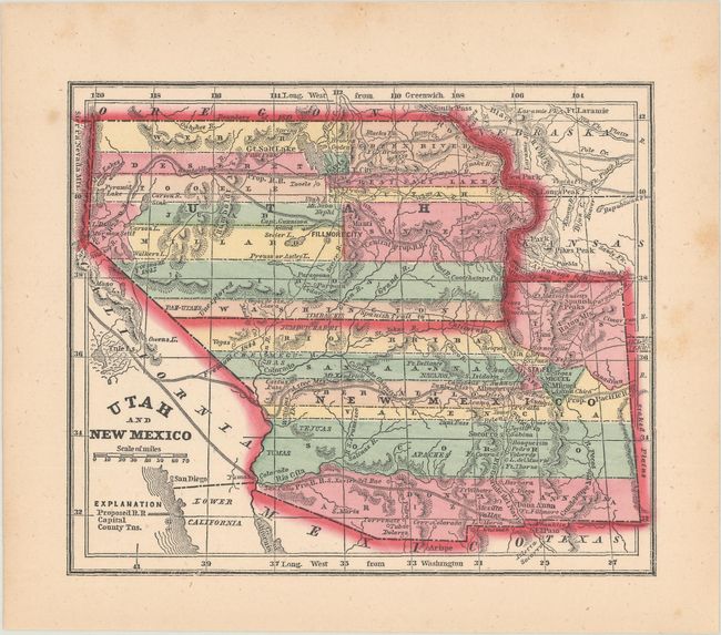
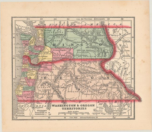
Subject: Western United States

Period: 1851-56 (circa)

Publication:

Color: Hand Color

Size:
See Description
Download High Resolution Image
(or just click on image to launch the Zoom viewer)

A. Map No. 10. United States, by Cady & Burgess, dated 1851 (8.9 x 10.4"). This historical map of the West shows early territorial boundaries. New Mexico Territory is shown with the pre-Gadsden Purchase border along the Gila River plus its northeastern extension into today's Colorado. Oregon covers Washington and east to the Continental Divide and a huge North West Territory occupies the area to the east with a small area northeast of Utah labeled Nebraska. The large Utah Territory reaches to California and to the Continental Divide in today's Colorado and touches a small portion of the unnamed Indian Territory, which locates the lands of the Arapaho and Cheyenne. States/territories are labeled with their population: Utah 11,000, New Mexico 62,000, Oregon 13,000, California 165,000. Locates numerous Indian tribes and military forts. Condition: Pleasant light toning with a few minor spots of foxing. (B+)

B. [Lot of 2] Utah and New Mexico [and] Washington & Oregon Territories, by Morse & Gaston, circa 1856 (6.2 x 5.0"). Two maps of the western United States from the popular Diamond Atlas.... The map of Utah/New Mexico shows both territories in their largest configurations with long horizontal counties. Arizona makes an early appearance along the southern boundary of New Mexico Territory. The map of Washington/Oregon shows county development mostly confined to west of the Cascades, and the proposed Northern Pacific Railroad winding through Washington Territory. Condition: On bright sheets with a few spots of foxing confined to the blank margins. (A)

References:

Condition:

See description above.

Estimate: $160 - $200

Sold for: $120

Closed on 6/6/2018

Archived