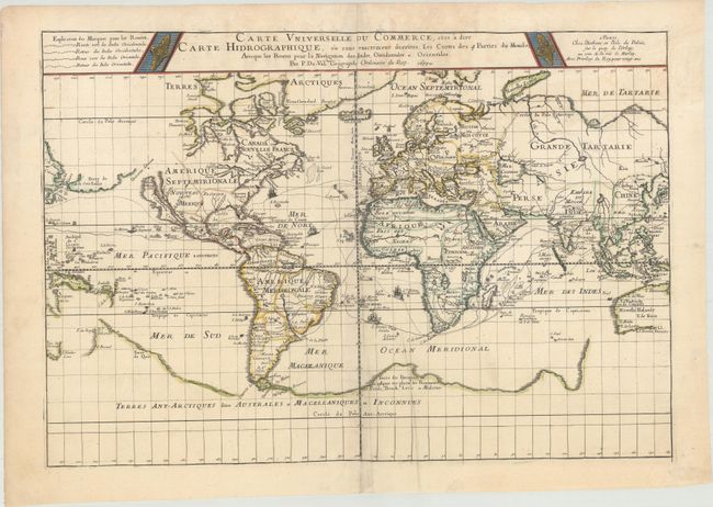
Duval's map on Mercator's projection focuses on the trading routes to the East and West Indies. A key at top left identifies the routes both to and from these important trade locations. The map also includes a number of geographical misconceptions and inaccuracies. Nowelle Holande is depicted in an unusual and less accurate form, despite the fact that Duval's map of the East Indies from the same atlas gives an updated depiction of the continent. In North America, California is shown as an island, and the Great Lakes are open-ended towards the west. A large Terre de Iesso spans nearly the entire North Pacific. In South America, two mythical lakes still appear: Lake Xarayes in Brazil and Lake Parime in Guyana with the fabled gold city of Manoa on its northwestern shore. Another mythical lake, Lake Chimay, is shown west of China, with five rivers flowing south. Duval also depicts a massive southern continent, which is attached to Nouvelle Zelande and is labeled Terres Ant-Arctiques dites Australes et Magellaniques et Inconnues. Pierre Duval was Nicolas Sanson's nephew and pupil. He published a wide range of atlases and individual maps with many of the maps based on Sanson. This is the second of three states of the map, which was originally published in 1674.
References: Shirley #465; Pastoureau, DUVAL II E [59].
Condition: B+
Contemporary outline color on a sheet with a large coat of arms watermark, very light soiling, a few extraneous creases, and a few tiny worm holes only visible when held to light. A centerfold separation at top has been archivally repaired.