Catalog Archive
Auction 168, Lot 179

Dutch Chart of the Carolinas

"Pas Kaart van de Kust van Carolina Tusschen C de Canaveral en C Henry", Keulen, Johannes van

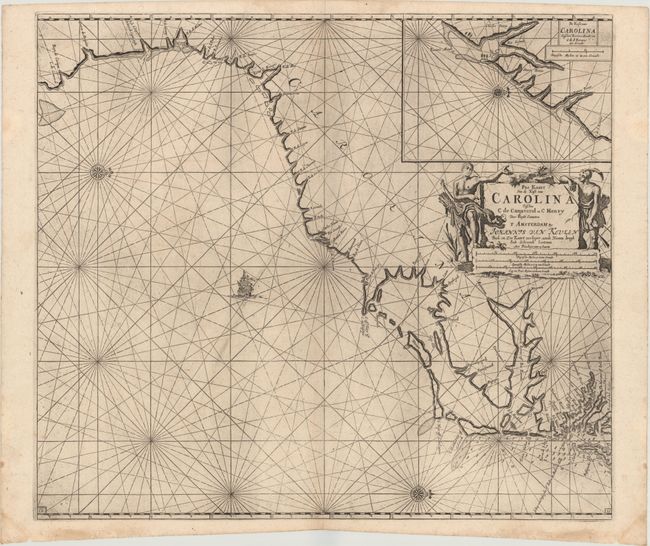
Subject: Colonial Southeastern United States

Period: 1780 (circa)

Publication:

Color: Black & White

Size:
23 x 20.3 inches
58.4 x 51.6 cm
Download High Resolution Image
(or just click on image to launch the Zoom viewer)

This scarce Dutch sea chart is one of the most handsome early maps of the Carolina coastline. It covers the coast from the southern part of the Chesapeake Bay to Cape Canaveral in northern Florida with north oriented to the right. It also includes a large inset of Charleston Harbor showing Charles Towne in its original location on the west bank of the Rio Grande (Ashley River). The chart uses Le Moyne and White nomenclature in addition to old Spanish names for some of the capes, reflecting the lack of any significant settlement or discoveries made in this region during the 17th century. Drawn by C.J. Vooght and published in Van Keulen's Zee-Fakkel and Zee-Atlas. This is a late edition of the third state with page number 18 engraved in both lower corners.

References: Burden #589; Cumming (SE) #91, plt. 40.

Condition: A

A dark impression with light printer's ink residue. There are some light damp stains in the bottom blank margin causing a few short tears that have been closed on verso with archival tape.

Estimate: $1,800 - $2,200

Sold for: $1,000

Closed on 6/6/2018

Archived