Catalog Archive
Auction 168, Lot 138

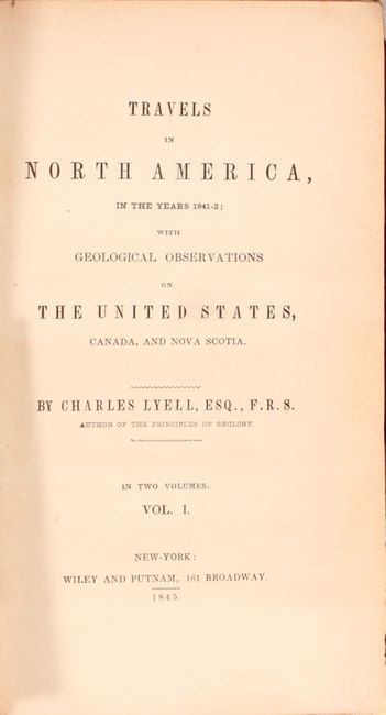
First American Edition of Lyell's Important Account & Geological Map

"Geological Map of the United States Canada &c. Compiled from the State Surveys of the U.S. and Other Sources [with] Travels in North America, in the Years 1841-2; with Geological Observations on the United States, Canada, and Nova Scotia", Lyell, Charles

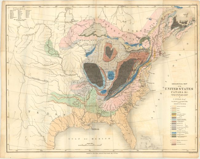
Subject: Eastern United States & Canada

Period: 1845 (published)

Publication:

Color: Hand Color

Size:
19.6 x 15.2 inches
49.8 x 38.6 cm
Download High Resolution Image
(or just click on image to launch the Zoom viewer)

This is an important and early geological map by Sir Charles Lyell. Its color-coded key identifies 20 different geological units. The map extends to about the 110th meridian to include the Republic of Texas, Arkansas, Missouri, and the North West Territory. Lyell had two major and controversial goals in publishing his work and this map: first, he endeavored to establish a strict uniformitarian theory of the earth's geology, and also to standardize the terminology and methodology employed in the science of geology. This theory posits that the laws of nature are unwavering through space and time. His map, along with James Hall's work of 1843, is a landmark improvement in geological representations and mapping.

The map is accompanied by Lyell's important account of his travels in the region. Lyell, already an eminent naturalist and geologist when he arrived in America, journeyed up the Hudson River and across New York to Niagara Falls. From there he traveled through Pennsylvania, New Jersey, the Alleghenies, Carolinas, and into Kentucky and Ohio before completing his journey via the St. Lawrence River to Nova Scotia. His keen observations were as much social and political as they were geological, with discussion of education, economics, and racial issues. This is the first American edition, two volumes in one (251 page and 231 pages). Includes a total of 7 plates (3 colored) with the attractive "Birds-Eye View of the Falls of Niagara & Adjacent Country" serving as the frontispiece to volume one. Octavo, hardbound in brown cloth with gilt title on spine.

References: Marcou & Marcou #34; Howes #L575; Sabin #42761.

Condition: B+

The colorful folding map has light offsetting and a few minor spots of foxing. The plates are generally very good with some scattered foxing to the two fossil plates, and a 3.5" tear along the right edge of the Niagara Falls frontispiece. The text is clean, bright, and near fine. The front hinge is starting and there are some minor chips to the head and tail of the spine. Covers have light wear and bumped edges.

Estimate: $750 - $900

Sold for: $750

Closed on 6/6/2018

Archived