Catalog Archive
Auction 168, Lot 10

One of the First Thematic Maps

"Designatio Orbis Christiani", Mercator/Hondius
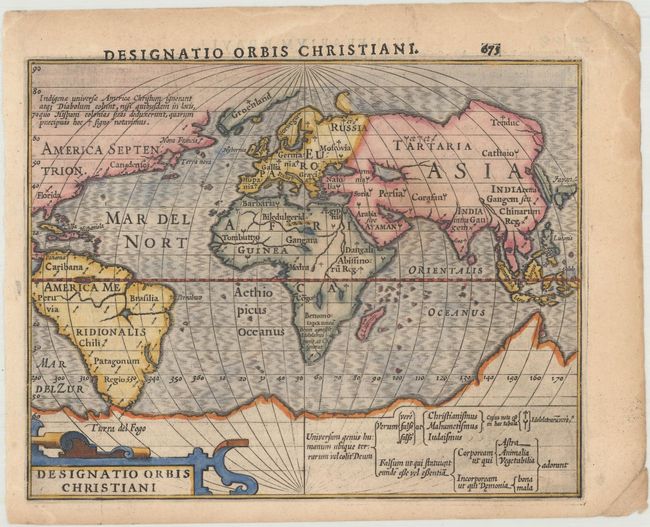
Subject: World

Period: 1610 (published)

Publication: Atlas Minor

Color: Hand Color

Size:
7.4 x 5.8 inches
18.8 x 14.7 cm
Download High Resolution Image
(or just click on image to launch the Zoom viewer)

This is one of the first thematic maps, and it is the second world map in the Mercator-Hondius Atlas Minor. It is drawn on a planispherical projection and uses symbols (identified in the key at bottom) to designate those areas of the world that are Christian (cross), Muslim (crescent), and pagan (arrow). It shows most of the world, excluding the west coast of North America. In Asia, Korea is shown as an island. The Nile rises from twin lakes in southern Africa. There is a huge southern continent that incorporates the landmass of Australia. Latin text on verso.

References: Shirley #260; Van der Krogt (Vol. III) #0001H:351.

Condition: B+

An excellent impression on watermarked paper with minor toning, a faint stain in southern Asia, and a few small damp stains along the edges of the sheet.

Estimate: $300 - $400

Sold for: $325

Closed on 6/6/2018

Archived