Catalog Archive
Auction 168, Lot 108

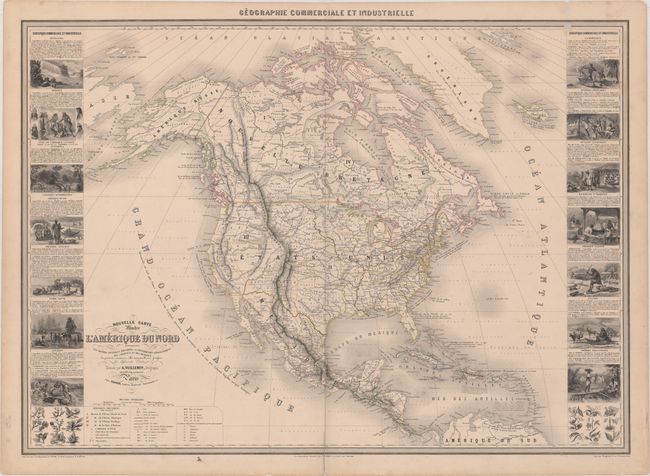
"Nouvelle Carte Illustree de l'Amerique du Nord Indiquant les Grandes Divisions Physiques, la Distribution Geographique des Vegetaux et des Mineraux...", Vuillemin, Alexander A.
Subject: North America

Period: 1855 (dated)

Publication:

Color: Hand Color

Size:
33.1 x 23.6 inches
84.1 x 59.9 cm
Download High Resolution Image
(or just click on image to launch the Zoom viewer)

This superb large chart from this scarce nineteenth century atlas that extends to include Greenland, Iceland, and an unengraved portion of Northern Asia. The map is filled with an impressive array of information illustrating the physical and geographical divisions, colonial possessions in the Caribbean, roads, canals, railways, forts, mines, and the plant and mineral distributions. It is flanked by side panels containing numerous meticulously engraved vignettes representing the various industries and peoples of the different countries and regions. Alaska is labeled Amerique Russe. Within the western United States, there are a number of interesting territorial configurations: Territoire Indien extends into present-day Kansas, Nebraska, and Colorado; Minnesota stretches to include part of the Dakotas; a large Territoire du Nord Ouest includes present-day Montana, Idaho, Wyoming, and part of the Dakotas; and Utah and Oregon territories are at their peak size. The border of the Territory of New Mexico reflects the 1853 Gadsen Purchase. Topography engraved by Gerin, with assistance from Lefevre. The illustrations were designed by Testard and engraved by Guesnu.

References:

Condition: B+

Original outline color with a centerfold separation at bottom that extends 2.5" into the image which has been closed on verso with archival tape. There is light scattered foxing, remnants of a label at top right, and some short edge tears confined to the margins.

Estimate: $500 - $650

Sold for: $350

Closed on 6/6/2018

Archived