Catalog Archive
Auction 166, Lot 94

Rare Variant of Popple's Key Map

"Nova Mappa Geographica Americae Septentrionalis in Suas Praecipuas Partes Divisa", Probst, Johann Michael

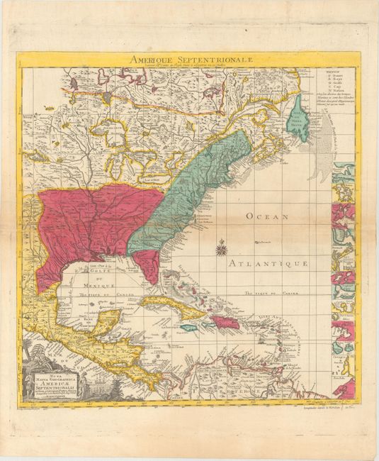
Subject: Colonial Eastern North America & West Indies

Period: 1782 (dated)

Publication:

Color: Hand Color

Size:
19.2 x 19.6 inches
48.8 x 49.8 cm
Download High Resolution Image
(or just click on image to launch the Zoom viewer)

This is a variant of the key map of Henry Popple's seminal map of North America, first published in 1733. This edition contains a geographical difference from the British original - Lake Champlain has two branches on the south end instead of one. The thirteen British colonies are clearly delineated, just one year before the formal peace treaty between the United States and Britain. At right is a column of inset maps including Boston, New York, Charlestown, St. Augustine, Bermuda and several others. The Spanish galleons' route from Vera Cruz to Havana is marked. The pictorial cartouche features Native Americans. The French title above the map is "Amerique Septentrionale Suivant la Carte de Pople…" This is the second state with Longitudes a l'Isle de Fer in the border at lower right (instead of de Londres in the first state).

References: McCorkle #782.14.

Condition: B+

Contemporary color with light toning along the centerfold, a few minor creases at left center, and light soiling in the blank margins.

Estimate: $1,600 - $1,900

Unsold

Closed on 2/14/2018

Archived