One of the Most Accurate Maps of China of the 18th Century
"Carte la Plus Generale et qui Comprend la Chine, la Tartarie Chinoise, et le Thibet Dressee sur les Cartes Particulieres des RR PP Jesuites", Du Halde/D'Anville
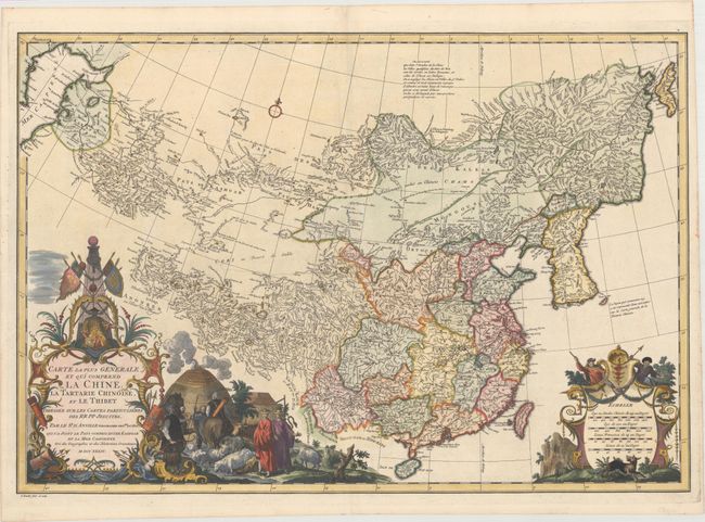
Subject: China & Korea
Period: 1734 (dated)
Publication: Description Geographique Historique... de l'Empire de la Chine...
A lovely copper engraved map that covers all of China from the Caspian Sea to an early depiction of Sakhalin Island. Remarkable detail throughout the region, based largely on a woodblock Chinese atlas commissioned by the Kangxi Emperor from Jesuit missionaries in China, which was completed in 1718 or 1719. This is one of the first western maps to include a relatively accurate depiction of Korea, which was forbidden territory for Europeans. The large, boldly engraved title cartouche features the Kangxi Emperor at top with a scene of two Jesuits entering a farm village filled with livestock. The distance scale cartouche includes two wolf hunters spying their prey. Engraved by G. Kondet.
References: Shirley (BL Atlases) T.HALD-1a #1.
Condition: A
Superb impression with minor toning along the edges of the sheet.