Catalog Archive
Auction 166, Lot 612

"Insula Candia Ejusque Fortificatio", Wit, Frederick de
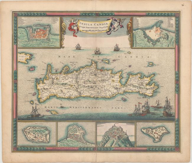
Subject: Crete

Period: 1688 (circa)

Publication:

Color: Hand Color

Size:
21.6 x 18.1 inches
54.9 x 46 cm
Download High Resolution Image
(or just click on image to launch the Zoom viewer)

This dramatic map of Crete shows the island following the Siege of Candia, a conflict in which Ottoman forces besieged the Venetian-ruled city until their ultimate victory 21 years later. The map is based on the cartography of Sebastien de Pontault de Beaulieu, who mapped many of the Mediterranean fortifications in about 1674. The island is filled with good information on roads, towns, and topography. Six insets showing the fortifications of Canea, Candia, Spina Longa, Retimo, Thine, and Suda are engraved in fine detail, with numbered keys identifying specific sites in Chania and Candia. The sea is filled with many war ships representing the epic struggle, and the banner-style title is held aloft by two putti.

References: Zacharakis #2392.

Condition: B+

A nice impression with a centerfold separation at bottom that extends 1" into the image that has been archivally repaired.

Estimate: $1,100 - $1,400

Sold for: $650

Closed on 2/14/2018

Archived