Catalog Archive
Auction 166, Lot 419

"[The Severn or Channell of Bristoll]", Collins, Capt. Greenvile

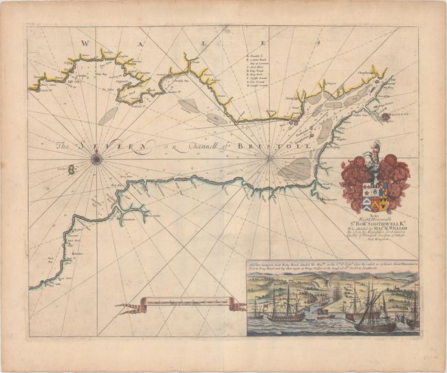
Subject: Bristol Channel

Period: 1693 (circa)

Publication: Great-Britain's Coasting Pilot

Color: Hand Color

Size:
21.5 x 17 inches
54.6 x 43.2 cm
Download High Resolution Image
(or just click on image to launch the Zoom viewer)

This map shows the Bristol Channel, which divides Wales and the western portion of England with the city of Bristol located at the right of the image. The map is filled with rhumb lines, numerous soundings, and a key at center to important locations. At the lower right is a view depicting the arrival of King William III on 6 September 1690, upon returning from Ireland following the Battle of Boyne and his defeat of James II. Sir Robert Southwell, who accompanied King William III, was the Secretary of the State for Ireland at the time. The map is dedicated to Sir Southwell and is decorated with his coat of arms.

In 1681 Capt. Greenville Collins (fl.1669-1694) an officer in the Royal Navy was appointed by the Admiralty to make a complete survey of the coasts of Great Britain. Prior to this date the charts used by English mariners were copies of Dutch charts that had many inaccuracies. The task of surveying the entire coasts was formidable and took about 7 years, at the end of which only 46 surveys were finally used in an atlas titled "Great Britain's Coasting-Pilot Being a New and Exact Survey of the Sea-Coast of England," which was first published in 1693.

References: Verner (MCC-58) #47; Shirley (BL Atlases) M.COLL-1a #14.

Condition: B+

Printed on heavy paper with some printer's ink residue, light soiling, and minor extraneous creasing in the image.

Estimate: $350 - $425

Sold for: $250

Closed on 2/14/2018

Archived