Catalog Archive
Auction 166, Lot 192

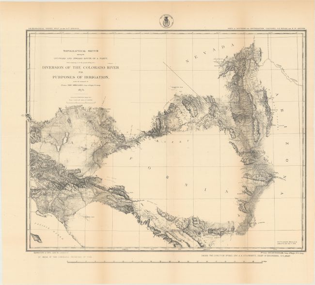
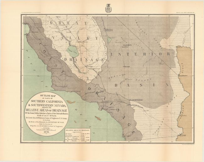
"[Lot of 2] Topographical Sketch Showing the Outward and Inward Route of a Party, While Examining as to the Practicability of a Diversion of the Colorado River... [and] Outline Map of Parts of Southern California & South-Western Nevada", Wheeler, George (Lt)

Subject: Southwestern United States

Period: 1875-76 (dated)

Publication:

Color:

Size:
See Description
Download High Resolution Image
(or just click on image to launch the Zoom viewer)

These two early maps relate to the use of irrigation in Southern California:

A. Topographical Sketch Showing the Outward and Inward Route of a Party, While Examining as to the Practicability of a Diversion of the Colorado River for Purposes of Irrigation..., dated 1875, black & white (19.1 x 14.8"). This map is an early effort at determining the practicality of getting water from the Colorado River to the Los Angles basin. Under the direction of Brig. Gen. A.A. Humphreys, 1st Lieut. Eric Bergland's route is here detailed as he explored a portion of the lower Colorado. The party's route appears to lead from Los Angeles east and north across southern California to the river, north to Store's Ferry, then south to Ehernberg. The inward route took them from Ehernberg west across the Coachella Valley, past San Bernardino and back to their starting point. The coast of Southern California is well mapped up to Santa Monica. Along the route is much detail with many places and features named. The reality of bringing water from the Colorado River was finally realized more than 65 years later with the completion of the Colorado River Aqueduct in 1941. The map shows the early towns of Southern California including Anaheim, San Pedro, Wilmington, and El Monte. The detailed topography is shown with hachure. This map is a great example of stone lithograph with the fine texture of the stone clearly visible.

B. Outline Map of Parts of Southern California & South-Western Nevada, Showing the Relative Areas of Drainage of the Coast..., dated 1876, printed color (19.2 x 14.3"). Covers the region from the Colorado River to the Pacific Ocean with good detail of the river systems and railroads. The map is divided into four distinct drainage areas including the coast, valley, interior, and the Colorado in California.

References:

Condition: B+

Issued folding with light toning along the folds.

Estimate: $180 - $220

Sold for: $120

Closed on 2/14/2018

Archived