Catalog Archive
Auction 165, Lot 780

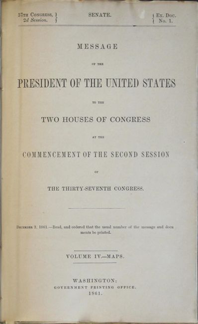
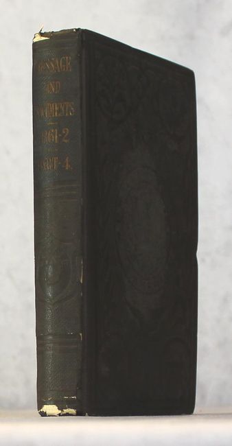
Scarce General Land Office Volume with 18 Maps

"[GLO Atlas] Message of the President of the United States to the Two Houses of Congress at the Commencement of the Second Session of the Thiry-Seventh Congress Volume IV. Maps", General Land Office

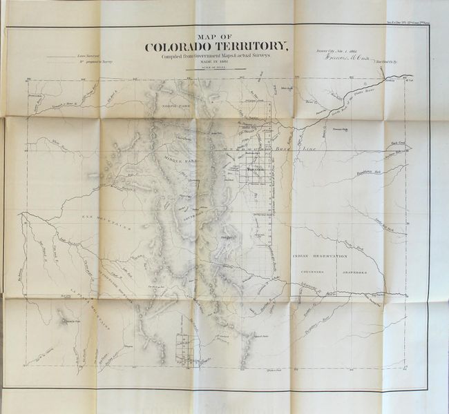
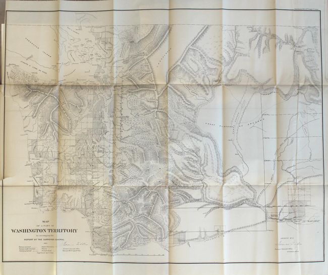
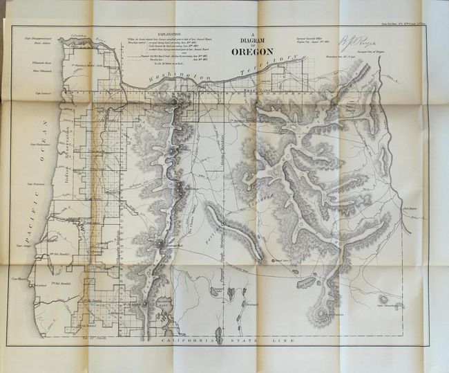
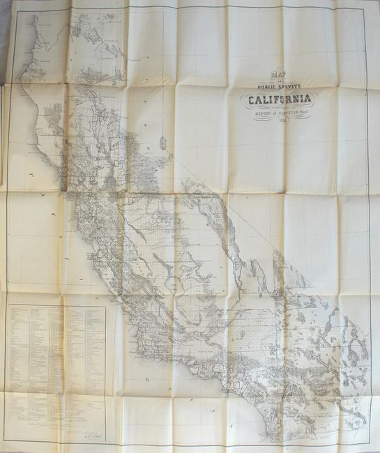
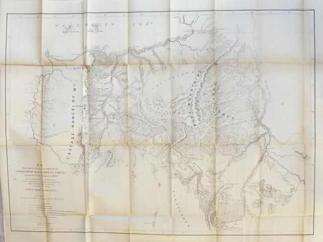
Subject: Exploration & Surveys, Western United States

Period: 1861 (published)

Publication: Sen. Ex. Doc. 1, 37th Congress, 2nd Session

Color: Black & White

Size:
5.9 x 9.1 inches
15 x 23.1 cm
Download High Resolution Image
(or just click on image to launch the Zoom viewer)

This is one of the scarcer and more desirable volumes issued by the General Land Office. It contains a total of 18 maps (16 folding) and 16 diagrams including the first official map of Colorado Territory (20.8 x 17.8"). It is signed in the plate "Denver City Nov. 1st 1861. Francis M. Case Sur. Genl. Co. Ty." The map has good detail considering this early attempt at mapping the territory. Details include watershed, mountains in hachure, and survey status shown along the plains just east of the Front Range. The towns of Denver, Colorado City (Colorado Springs), Boulder City, Golden City, Pueblo, Canon City, Breckenridge, Central City, Ft. St. Vrain are shown. Mountains named include Pike Peak, Longs Peak, Spanish Peaks, etc. The map is centered on the San Luis Valley and the parks - South, Middle and North. In the plains is the Indian Reservation divided between the Cheyennes and Arapahoes. The volume also includes Map of a Part of Washington Territory (27.9 x 21.8"), which shows the majority of the population west of the Cascades and little more than military outposts and unexplored areas to the east, and Sketch of the Public Surveys in New Mexico (32.5 x 23.0") which centers on Santa Fe, and shows the locations of numerous towns, reservations and forts including Union, Bliss and Defiance. Other notable maps includes Oregon Territory (22.7 x 17"), the state of California (30.3 x 35.5"), and Map Showing the Routes travelled by the Command of Majr E. Steen, U. S. Drags., against the Snake Indians in 1860 (33.5 x 24"). Octavo, hardbound in brown cloth with bilnd-stamped boards and gilt title on spine.

References:

Condition: B

The maps have light toning along the folds, occasional minor splits at fold intersections, and a few short binding tears that just enter the images. The map of Colorado is trimmed to just inside the neatline at left as issued, and the maps of New Mexico and California have moderate toning along one fold with minor loss at a few fold intersections. There is light wear and stains to the covers, bumped edges, and some minor chips at the head and tail of spine.

Estimate: $1,000 - $1,300

Sold for: $300

Closed on 11/15/2017

Archived