Catalog Archive
Auction 165, Lot 77

Decorative Chart of the Western Atlantic Coast

"Pas Kaart van West Indien Behelsende soo Deszelffs Vaste Kusten als d'Onder Behoorende Eylanden aan de Noord Oceaan...", Keulen, Johannes van

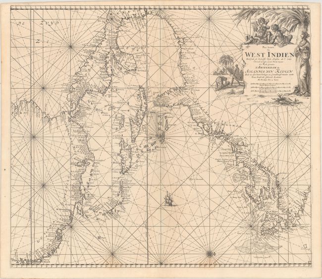
Subject: Colonial Eastern North America & West Indies

Period: 1687 (circa)

Publication: De Nieuwe Groote Lichtende Zee-Fakkel

Color: Black & White

Size:
23.1 x 20.2 inches
58.7 x 51.3 cm
Download High Resolution Image
(or just click on image to launch the Zoom viewer)

This superb chart depicts the coastline of the western Atlantic Ocean from the mouth of the Amazon River in Brazil to Labrador, Canada. Detail is confined to the coastlines, which are filled with place names, including Charleston, Manhattans Eyl., Plymouth, Boston, Salem, and Quebec. The St. Lawrence River is labeled Le Grand Rivier de Canada. The Caribbean islands are well defined, and numerous fishing banks, rocks, shoals and other navigational hazards are shown. A single compass rose orients north to the right. The map is adorned with a single sailing ship and a decorative title cartouche featuring putti and natives collecting bundles of sugar can. This is the second state with engraved plate number 1 at bottom right.

References: McCorkle #680.3.

Condition: A

Excellent impression with a hint of toning along the centerfold and two faint stains along the bottom border.

Estimate: $4,500 - $5,500

Sold for: $3,750

Closed on 11/15/2017

Archived