Catalog Archive
Auction 165, Lot 650

"Carte de l'Asie Selon les Auteurs Anciens Enrichie de Remarques Historiques sur les Changemens qui y sont Arrivez", Chatelain, Henry Abraham
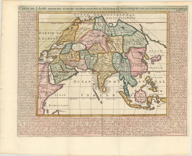
Subject: Asia

Period: 1720 (circa)

Publication: Atlas Historique

Color: Hand Color

Size:
19.2 x 14.8 inches
48.8 x 37.6 cm
Download High Resolution Image
(or just click on image to launch the Zoom viewer)

This historical map of Asia and the East Indies depicts the parts of Asia known during ancient times. Geographically it is based on Sanson's Asia Vetus with a huge unidentified landmass to the east of the continent and Japan on Tiexeira's outline. The Philippines are identified as the Isles Sabadines. Surrounded with panels of French text by Nicholas Gueudeville.

References:

Condition: A

A sharp impression on a clean, bright sheet, issued folding on paper with a Strasbourg Lily and "IV" watermarks. There is minor toning along the edges of the sheet.

Estimate: $200 - $230

Sold for: $100

Closed on 11/15/2017

Archived