"Atlantic & Pacific Junction. Topographical Map of a Portion of the Isthmus of Darien in Site of Proposed Inter-Oceanic Navigation, August, 1852", Gisborne, Lionel
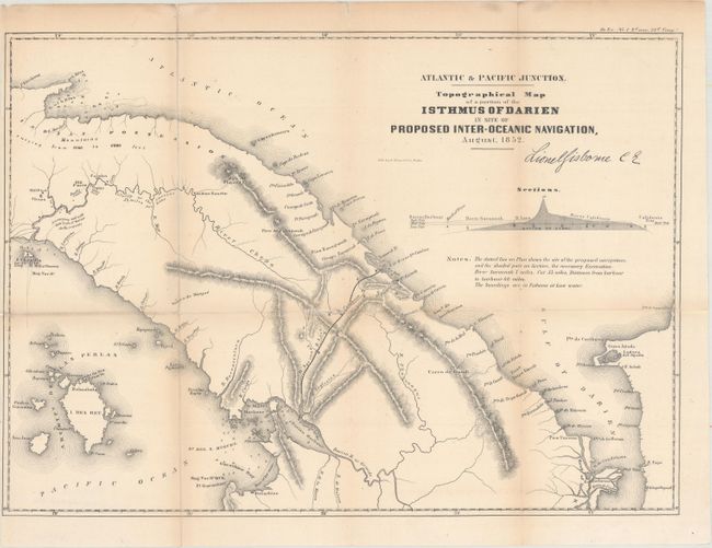
Subject: Panama
Period: 1854 (published)
Publication: House Ex. No. 1 - 2nd Session 33rd Cong.
Nice detailed lithographed map showing the site of the proposed canal from Caledonia Bay in the Atlantic to Darien Harbor in the Pacific. Profile of the canal and notes describe the proposed canal, soundings, etc. This map was first published in Lionel Gisborne's "The Isthmus of Darien in 1852: Journal of the Expedition of Inquiry for the Junction of the Atlantic and Pacific Oceans," which documented Gisborne's exploration of northern Columbia, Panama, the Scottish colony of Darien, with observations of social customs, native life, the Panama railway, gold mines, climate, etc. This edition was published by the U.S. Government for the 33rd Congress, 2nd Session.
References:
Condition: B+
Issued folding, now flattened, with the folds archivally reinforced on verso and repairs to a tiny hole at a fold intersection and a small hole along a fold. Narrow left margin, as issued.