Catalog Archive
Auction 165, Lot 304

"Map of the Country Adjacent to the Left Bank of the Rio Grande Below Matamoros...", U.S. Government

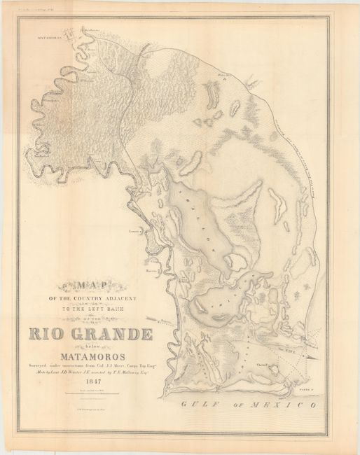
Subject: Southern Texas

Period: 1847 (dated)

Publication: Sen. Ex. Doc. 65, 31st Congress, 1st Session

Color: Black & White

Size:
18.9 x 25.1 inches
48 x 63.8 cm
Download High Resolution Image
(or just click on image to launch the Zoom viewer)

This topographical map was created by Lieut. John D. Webster with assistance from T.E. Mullomny. It details a strategic portion of the Rio Grande from Matamoros to Boca Chica at the southernmost tip of Texas, an area with significance in the Mexican-American War. Details includes forts, camps, roads and towns, topography by hachure, vegetation, and numerous soundings in the Rio Grande. Fort Brown is located across the Rio Grande from Matamoros. Along the Gulf are located Padre Island, Clark's Island, Brazo Santiago, and Port Isabel. The small settlements of Falcone, Burgos, Tres Quilas, Arenal, and Burrita are located along the Rio Grande, to mention a few. Drawn on the scale of one inch per mile, accounting for the remarkable level of detail.

References:

Condition: B+

Issued folding with light toning and faint offsetting.

Estimate: $250 - $325

Sold for: $200

Closed on 11/15/2017

Archived