Catalog Archive
Auction 165, Lot 289

"[3 Maps Bound in Report] Map of the Valley of the Alleghany River [and] Survey of the Allegheny River from Franklin to Pittsburgh ... No. 1 [and] No. 2 [in report] Survey of Allegany River...", U.S. War Department

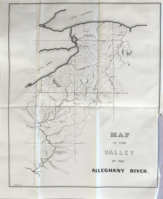
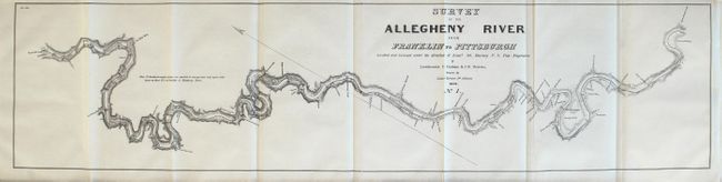
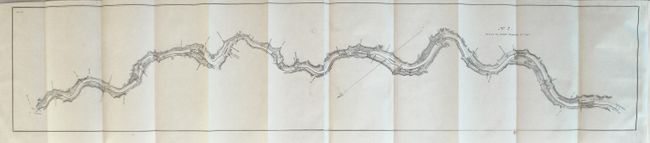
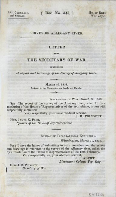
Subject: Western Pennsylvania

Period: 1838 (published)

Publication: HR Doc. 343, 25th Cong., 2nd. Sess.

Color: Black & White

Size:
5.5 x 8.7 inches
14 x 22.1 cm
Download High Resolution Image
(or just click on image to launch the Zoom viewer)

This 36 page report includes 2 maps (on 3 sheets) showing the recent survey results along the Allegheny River. The first map, Map of the Valley of the Alleghany River (11.0 x 13.6") provides an overview of the entire river and its tributaries from the headwaters just east of Coudersport, PA. to the confluence with the Ohio River at Pittsburgh. The second map entitled Survey of the Allegheny River from Franklin to Pittsburgh shows finer detail of the survey made by topographical engineers Lieutenants C. Graham and J.M. Berrien under the direction of Lt. Col. Kearney. Details along the banks of the river include ferries, creeks, salt works, property owners, and more. The first sheet measures 31.2 x 7.4" and the second sheet is 37.9 x 7.4".

References: Claussen & Friis #240 & #241.

Condition: A

The folding maps are clean and crisp. The "Map of the Valley of the Alleghany River" has a short binding tear at right that just passes the border. Disbound report text is very good with faint scattered foxing.

Estimate: $150 - $180

Sold for: $50

Closed on 11/15/2017

Archived