Catalog Archive
Auction 165, Lot 215

Scarce, Early, Octavo Pacific Railroad Report with Gunnison Map

"Sketch of Capt. Gunnison's Route to Sept. 20, 1853 Central Pacific Railroad Exploration [together with original report and maps]", U.S. War Department
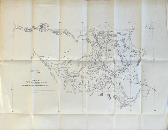
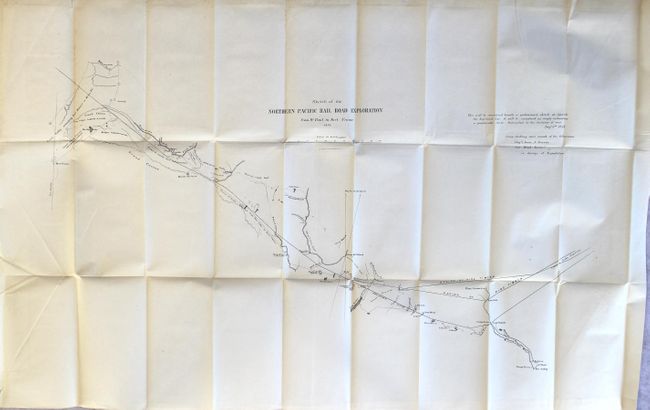
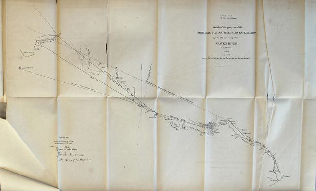
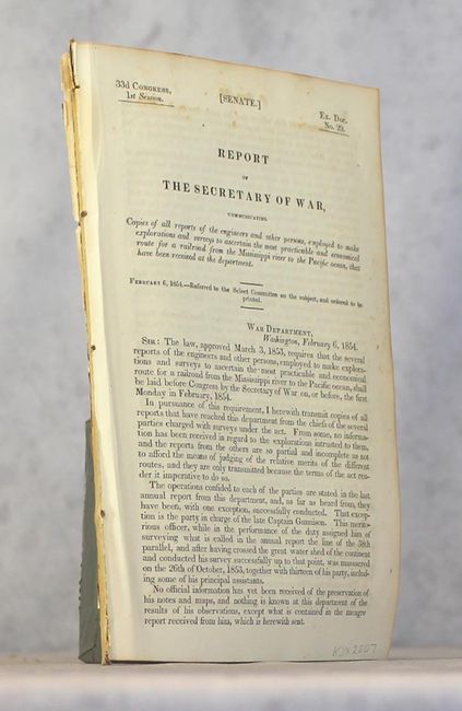
Subject: Colorado

Period: 1854 (published)

Publication: Sen. Ex. Doc. 29, 33rd Cong., 1st Sess.

Color: Black & White

Size:
20 x 13 inches
50.8 x 33 cm
Download High Resolution Image
(or just click on image to launch the Zoom viewer)

This map was issued in the scarce, preliminary octavo edition of the Pacific Railroad Surveys that preceded the quarto edition by over a year. Wheat mentions the map on page 202 (volume four) under the much larger Gunnison & Beckwith map (TMW #842) that covers from St. Louis to San Francisco. On this smaller and earlier map, the central region of Colorado is several times more detailed. The route follows the Arkansas River valley to includes today's La Vita Pass, Garland, Gunnison and the vicinity of Grand Junction. The last camp is dated September 20th. Barely five weeks later Gunnison and Kern were killed near Siever Lake, Utah. Two additional maps are included: Sketch of the Northern Pacific Railroad from St. Paul to Ft. Union (32 x 18") and Sketch of the Progress of the Northern Pacific Railroad Exploration up to the crossing of the Shayen River (26 x 16"). The three maps are all bound into the back of the 118 page disbound report.

References: cf. Wheat (TMW) #842.

Condition: B+

The Gunnison map and the "St. Paul to Fort Union" map are near fine with just a few tiny spots of foxing and light toning along the sheet edges (A). The "Shayen River" sheet has a 6" fold separation, light toning, and a few extraneous creases (B). Disbound report is very good with only occasional foxing.

Estimate: $700 - $900

Sold for: $500

Closed on 11/15/2017

Archived