Catalog Archive
Auction 165, Lot 189

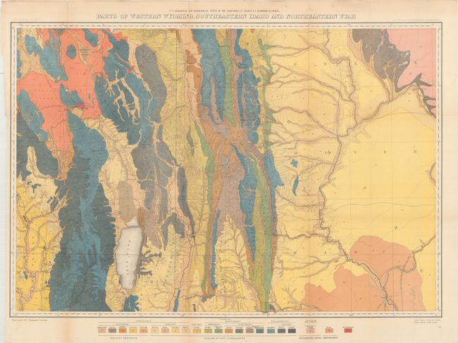
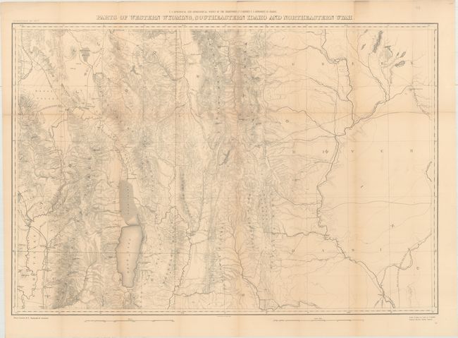
"[Lot of 2 - Geological and Topographical Maps] Parts of Western Wyoming, Southeastern Idaho and Northeastern Utah", Hayden, Ferdinand Vandeveer

Subject: Western United States

Period: 1883 (published)

Publication: Hayden's 12th Annual Report

Color: Printed Color

Size:
33.4 x 22.9 inches
84.8 x 58.2 cm
Download High Resolution Image
(or just click on image to launch the Zoom viewer)

These two maps were issued in Hayden's 12th Annual Report for 1879, but not published until 1883. The maps are identical in size and scale, and show all land from the Green River Basin in the east to the Bear River Range to the west. They extend north to include part of Gary's Lake and details the Aspen, Salt River and Wyoming Ranges in the north, and extends south below Bear Lake to Logan. The maps further locates numerous settlements and includes Fremont’s Lake adjacent to today's Pinedale. In addition to the topographical features found on both maps, the geological map uses bold color and pattern to depict 22 different geologic types including recent deposits, sedimentary formations, and metamorphic rocks. Survey work completed by Henry Gannett. A nice pair of maps that is uncommonly seen together.

References: Wheat (TMW) #1296.

Condition: B+

Issued folding and now flattened and backed with tissue to reinforce and repair a few minor fold separations. Faint toning along the folds.

Estimate: $275 - $350

Sold for: $100

Closed on 11/15/2017

Archived