Catalog Archive
Auction 165, Lot 188

"Geological Map of Portions of Wyoming, Idaho and Utah", Hayden, Ferdinand Vandeveer

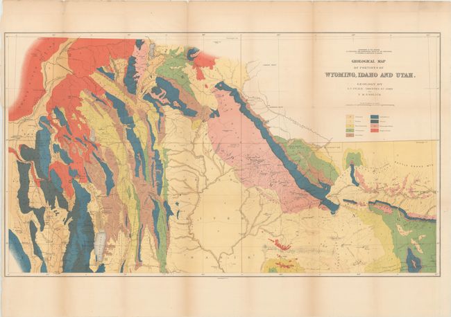
Subject: Western United States

Period: 1883 (published)

Publication: Hayden's 12th Annual Report

Color: Printed Color

Size:
36.3 x 20.5 inches
92.2 x 52.1 cm
Download High Resolution Image
(or just click on image to launch the Zoom viewer)

This map was issued in Hayden's 12th Annual Report for 1879 but not published until 1883. It is a handsome and colorful map that largely covers part of Idaho eastward to the Sweetwater Range. Topography and hydrology are nicely developed and an abundance of towns and villages are shown. Bear Lake is at lower left bordering Idaho and Utah, Rawlings is at lower right with a portion of the Union Pacific Railroad detailed. Locates wagon roads, trails, sand dunes, and has fine watershed details. Mining activity is clearly shown in place names like Miner's Delight, Camp Stambaugh, Atlantic City, etc. It locates Blackfoot, Rose Fork Agency (Fort Hall), John Gray's Lake, Caribou, the Wind River or Shoshone Reservation, and much more. Taylor's Bridge on the Snake River pre-dates Idaho Falls.

References: Wheat (TMW) #1296.

Condition: B

Issued folding and now flattened and backed with tissue to reinforce and repair a few minor fold separations. Light toning along the folds and several minor edge tears confined to the left blank margin.

Estimate: $200 - $250

Sold for: $75

Closed on 11/15/2017

Archived