Catalog Archive
Auction 165, Lot 112

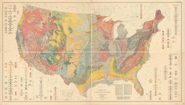
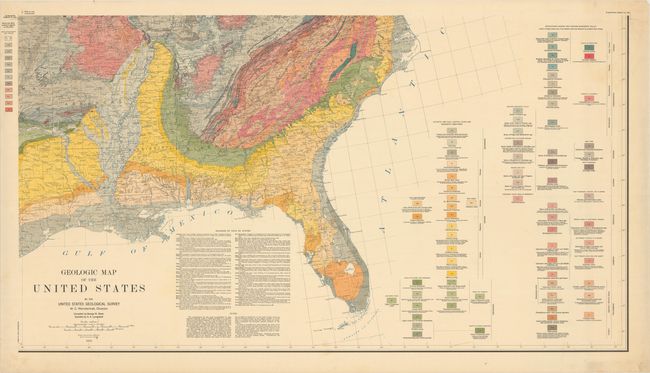
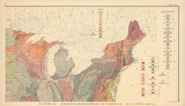
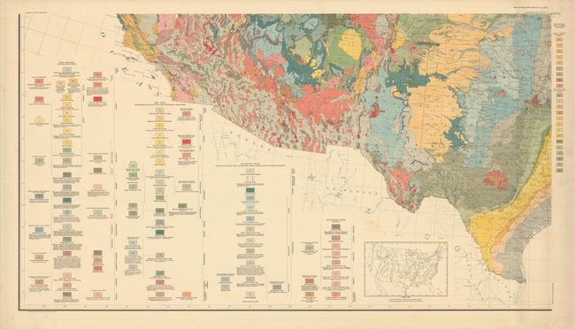
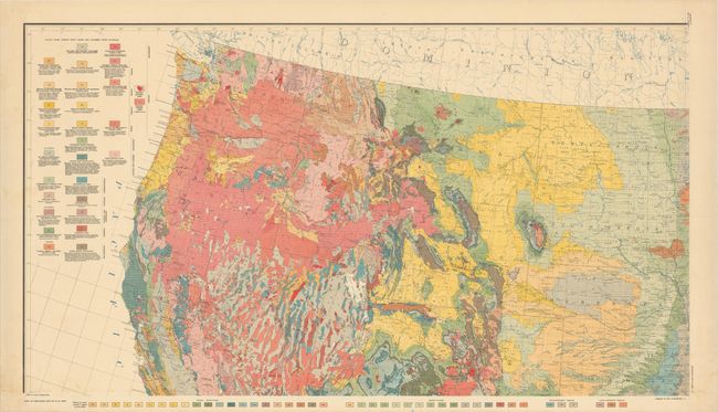
"[On 4 Sheets] Geologic Map of the United States", U.S. Geological Survey (USGS)

Subject: United States

Period: 1932 (dated)

Publication:

Color: Printed Color

Size:
45.1 x 24.6 inches
114.6 x 62.5 cm
Download High Resolution Image
(or just click on image to launch the Zoom viewer)

This incredibly detailed, geologic map of the United States was compiled by George W. Stose, assisted by O. A. Ljungstedt, and issued on four sheets. Although the U.S.G.S. published a geologic map of North America with the cooperation of Canada and Mexico in 1911, this geologic map of the United States was the first published of the country proper since McGee’s Reconnoissance Map of the United States, Showing the Distribution of the Geologic Systems So Far As Known in 1894, which had left large portions of the western US uncompleted. Many of the intervening years at the Survey were focused on refining stratigraphic correlations and publication of larger scale state geologic maps. This map stood as the standard reference work on the geology of the United States for the succeeding 40 years until replaced by a revised map authored by Philip B. King and Helen M. Beikman in 1974. This is an example of the scarce first printing; a later reprinting was made in 1960. If joined together, the map would measure an impressive 90 x 50". Published under the direction of W.C. Mendenhall.

References:

Condition: A

Vibrant color on bright sheets with a few faint spots. There are tiny pinholes in the blank margins, away from the images. Please note that the first image is a composite image that shows what the sheets would look like if joined; the sheets are separate.

Estimate: $200 - $300

Sold for: $600

Closed on 11/15/2017

Archived