Catalog Archive
Auction 165, Lot 100

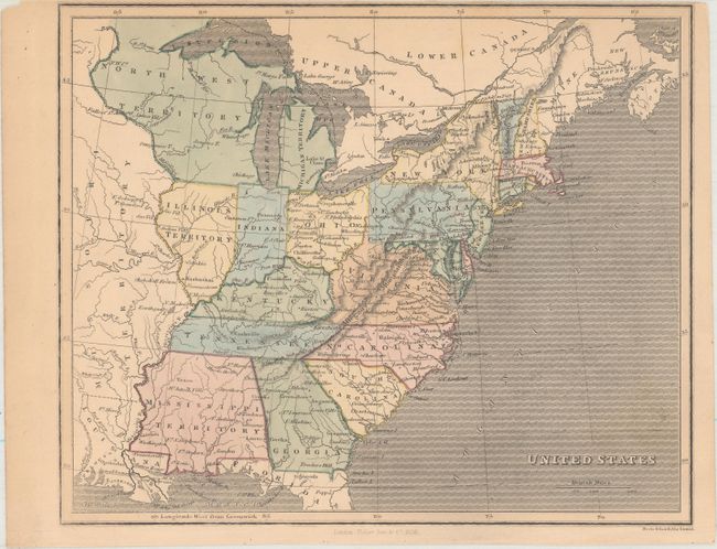
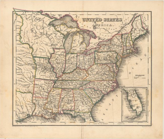
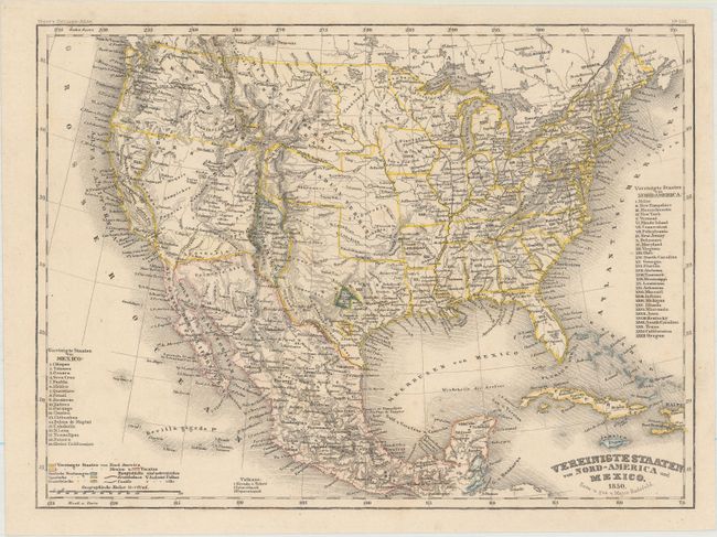
"[Lot of 3] United States [and] United States of America [and] Vereinigte Staaten von Nord-America und Mexico",

Subject: United States, Texas, Deseret

Period: 1836-50 (circa)

Publication:

Color: Hand Color

Size:
See Description
Download High Resolution Image
(or just click on image to launch the Zoom viewer)

A nice set of maps showing the progression of the United States in the early to mid 19th century including:

A. United States, by Fisher Son & Co., dated 1836 (9.7 x 8.0"). Despite the publication date, this map presents cartography consistent with circa 1815 as it depicts both Mississippi Territory and Illinois Territory. A large Missouri Territory occupies the lands to the west of the Mississippi River. Condition: Pleasant light toning. (B+)

B. United States of America, by John Dayton, circa 1837 (10.5 x 9.0"). This map was drawn by Drayon "from Tanner's map of the U.S." and was engraved by J. Yeager. It extends to include about half of the Independent Republic of Texas. The map shows a large Wisconsin Territory, Missouri, Arkansas, and Louisiana. The inset continues the lower half of Florida on the same scale. The map provides excellent detail throughout with a finely engraved line. Condition: Light color offsetting and a short centerfold separation at bottom that has been closed on verso with archival tape. (B+)

C. Vereinigte Staaten von Nord-America und Mexico, by Carl Christian Franz Radefeld, from Meyer's Zeitungs-Atlas, dated 1850 (10.1 x 7.5"). Very attractive, highly detailed map with unusual configurations of the western territories of the United States. Texas is in its early "stovepipe" configuration with an elongated panhandle that extends northward, nearly to 40°. In Texas the French Franz Col. colony and the German Mainzer Verein colony are highlighted in text and separate hand coloring. A very large territory of Deseret encompasses most of the Southwest with many obsolete towns and settlements named. The boundaries closely coincide with those proposed in the provisional State of Deseret constitution prepared by the Mormon leadership in 1849, making it one of the most accurate contemporary maps of Deseret. A small California only extends south to Yerba Buena with Gold Region and Sutter's Fort named. New Mexico Territory is a small area squeezed between Texas and the Continental Divide and includes Santa Fe and Taos. The large Indian Territory encompasses today's Oklahoma, Kansas, and part of Nebraska. An uncommon map that is very finely engraved in the German style. Condition: Original color with just a few faint spots of foxing. (A)

References:

Condition:

See description above.

Estimate: $250 - $325

Sold for: $180

Closed on 11/15/2017

Archived