Catalog Archive
Auction 164, Lot 726

NO RESERVE

"[Lot of 3] Western Australia, Swan River [and] New South Wales [and] Part of South Australia", Tallis, John
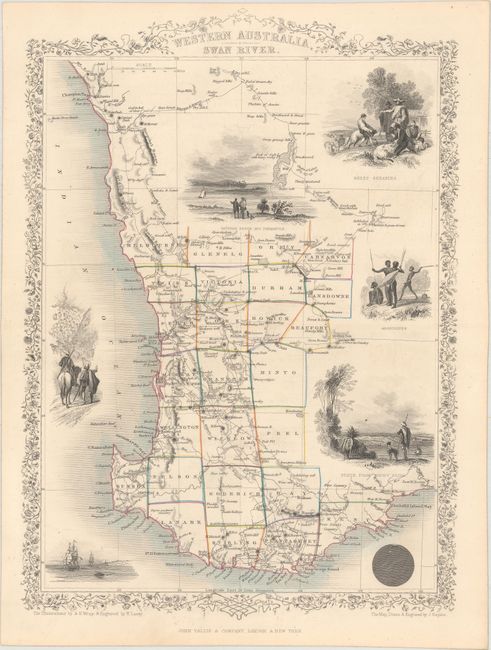
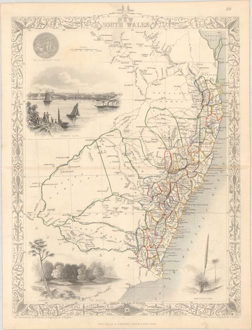
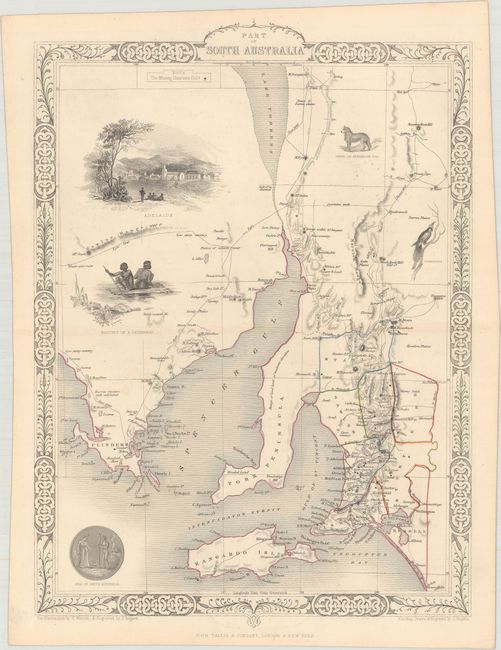
Subject: Australia

Period: 1850 (circa)

Publication: Illustrated Atlas and Modern History of the World

Color: Hand Color

Size:
9.7 x 13.5 inches
24.6 x 34.3 cm
Download High Resolution Image
(or just click on image to launch the Zoom viewer)

The maps from The Illustrated Atlas were first published in serial form to a target audience that led insular lives due to the expense and hardship of travel. All that changed as the progress of the nineteenth century brought swift and dramatic changes in public awareness of far away places. Tallis' maps no doubt played an important role in this dramatic awakening. These maps not only provided up-to-date geographical knowledge, but also used vignette views within the map's design to show the native people and their occupations, cities and points of interest. The maps hark back to a cartographic tradition from the Dutch mapmakers of the seventeenth century with finely engraved decorative borders. The maps were drawn and engraved by John Rapkin with views drawn and engraved by a number of prominent artists. The maps were issued as a complete volume from 1851 until about 1865. Some of the maps were also published in other history books published by Tallis including British Colonies and, without the vignettes, in geographical dictionaries and encyclopedias until about 1880.

A nice set of steel-engraved maps with decorative borders representing Tallis' view of southern Australia:

A. Western Australia, Swan River (9.6 x 13.6"). Lovely map of southwestern Australia centered on Perth and detailing its vicinity down to Doubtful Island Bay and north to above Champion Bay. Twenty five counties are named and delineated via hand coloring. Surrounded with seven vignettes including views between Perth and Freemantle, Perth from Mount Eliza, sheep herding and shearing, and one showing Aborigines with spears and shields.

B. New South Wales (9.9 x 13.5"). Lovely map of New South Wales with remarkable detail along the coastline. The map predates the discovery of gold in New South Wales and does not contain the notations concerning gold diggings found in later issues. Well rendered vignettes of the Seal of New South Wales, Sydney Cove, The Murray and a plant called Xanthorrhaea. The large vignette of Sydney is a lovely bird's-eye view from the harbor.

C. Part of South Australia (9.7 x 13.6"). Finely engraved map featuring a large and well-rendered vignette city view of Adelaide, natives on a canoe, and smaller vignettes of the state's seal, a dingo, and a tropical bird. The steel engraved map details the region to include Adelaide, Kangaroo Island, York Peninsula, and Spencer Gulf. Mining districts are noted with hand coloring as given by small legend at upper left.

References:

Condition: A

Original outline color on clean sheets. The map of New South Wales has one small area of faint toning in a blank section near the seal.

Estimate: $250 - $325

Sold for: $170

Closed on 9/13/2017

Archived